E13: Sites
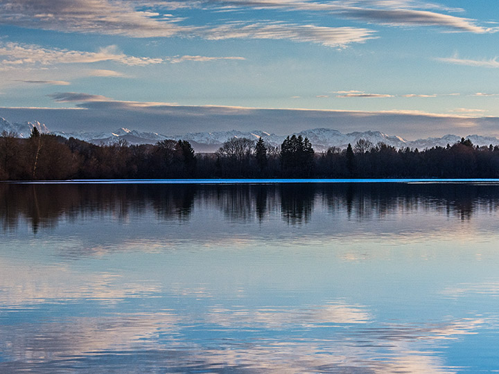
E13: Bamberg
Location Brief Description
Category: urban planning/architectural/landscape planning
Team representative: architect / urban planner
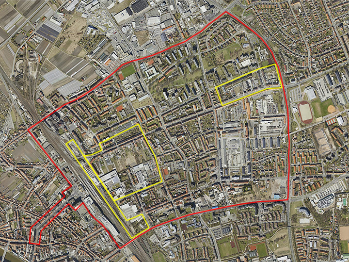
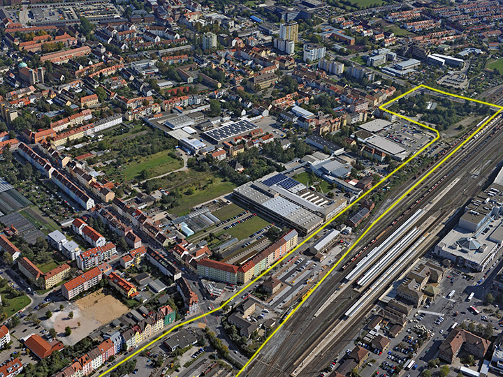
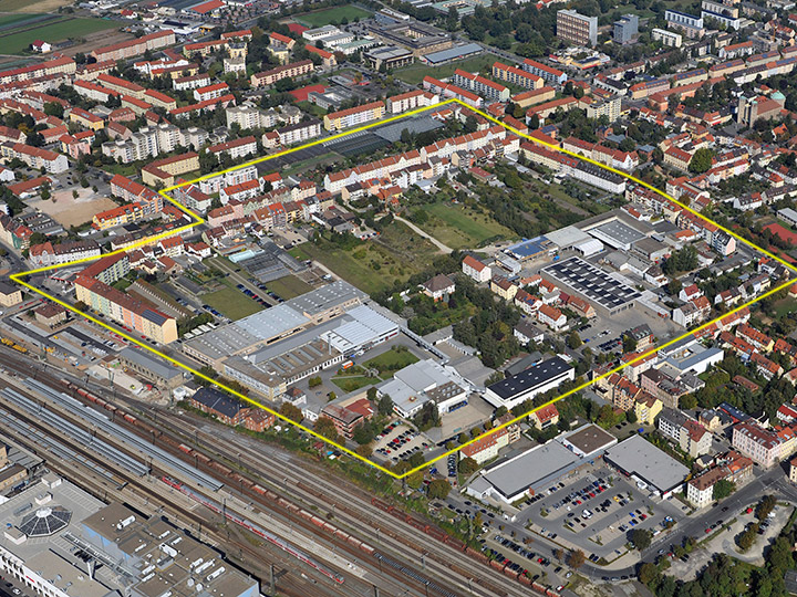
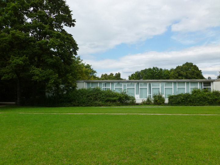
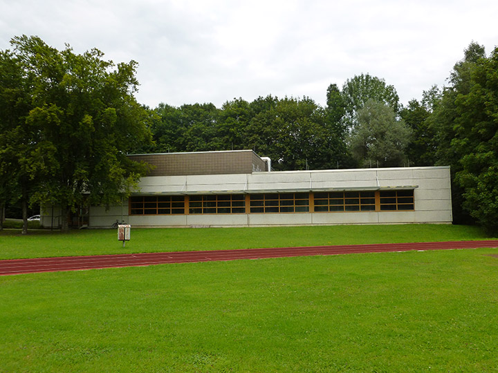
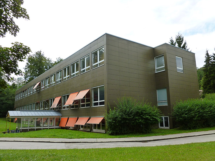
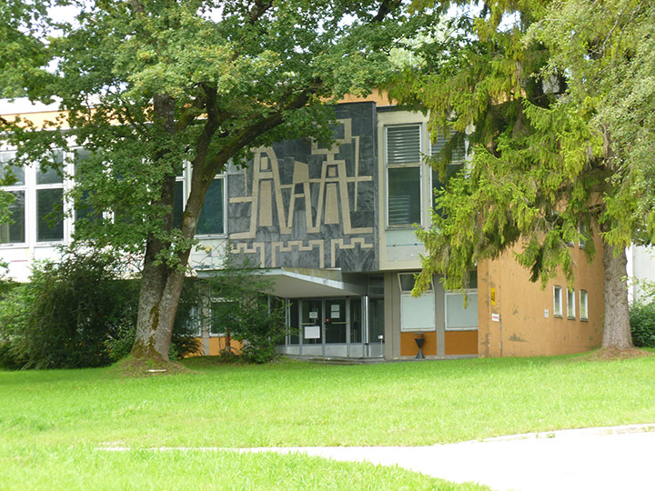
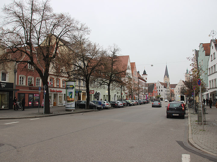
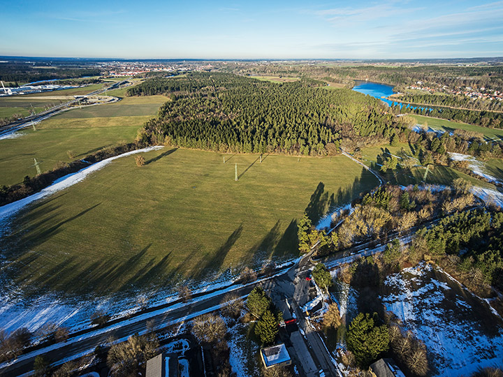
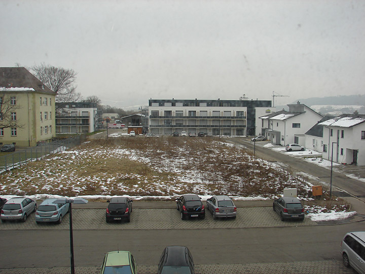
Location: Bamberg-East
Population: total city ca 71,000 / area under consideration ca 13,000
Area under consideration: ca 200 ha
Project areas: A 5.5 ha, B 18.1 ha, C 6.5 ha
Proposed location: City of Bamberg
Property owners: City of Bamberg, various private owners
Conversion areas: Federal Republic of Germany (BImA)
Acquisition: planned by the city of Bamberg
Type of commission: Framework plan or development plan
What can the site contribute to the Adaptable City?
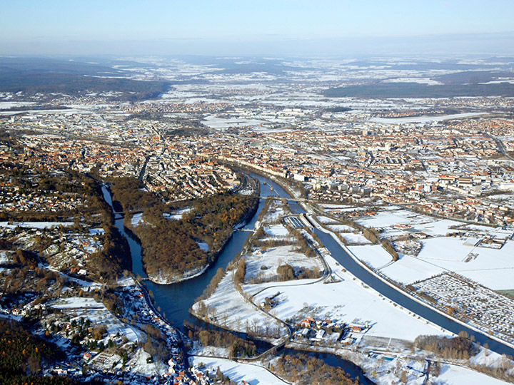
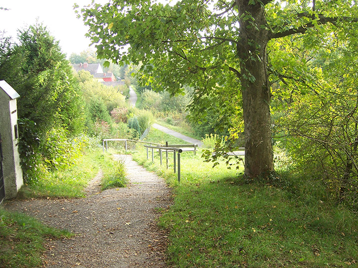
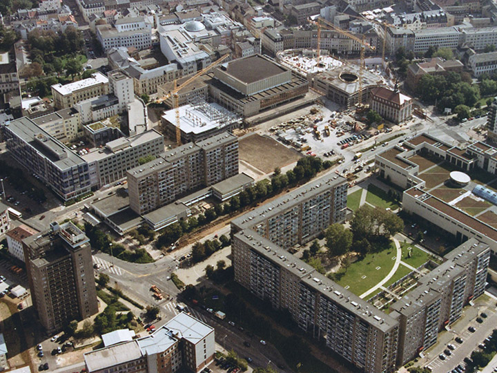
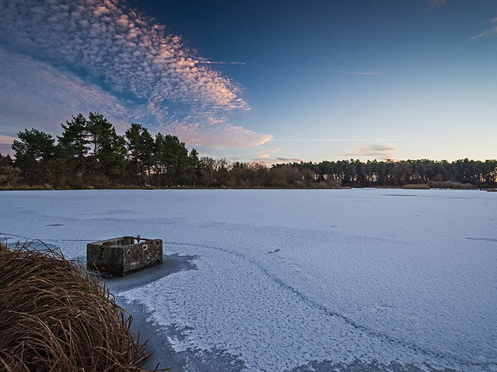
The east of Bamberg is a focal point of the urban development concept (SEK) adopted in 2014. Through the development and construction of attractive green and pathway connections in an east-west direction, the opening up and linking of the barracks area, Bamberg East and the city center in terms of urban space should succeed. A central element of the SEK is the vision of an East Park extending between Hauptsmoorwald and Lagarde Barracks. In order to establish a connection to the city center, the envisioned green and pathway connection must be continued in the direction of the train station. The mitigation of the caesura by the railroad line is a major challenge in this context. The goal is to make the special qualities of the east of Bamberg visible and to strengthen the identity of the neighborhood.
Strategic goals
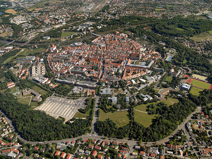
Bamberg is a medieval city that has been part of the UNESCO World Heritage since 1993. The historical division of the old town into mountain area, island town and gardener town can still be seen today and shapes the external perception of Bamberg.
The east of Bamberg, with the more recent settlement areas of the 20th century and extensive barracks areas, has so far been in the shadow of the old town and is clearly separated from it by the railroad line. With the abandonment of military use and the withdrawal of the Americans in 2014, this area is increasingly becoming the focus of planning. In order to integrate the conversion areas into the urban fabric and to strengthen the connection to the city center, the focus should be on the adjacent urban spaces in particular.
Location
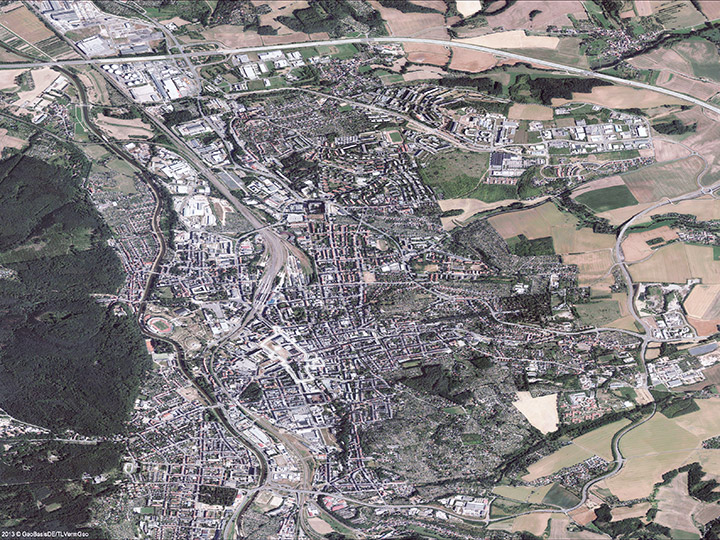
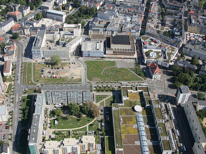
With a size of approx. 200 ha, the area under consideration stretches between the former barracks areas and the railroad station and therefore plays a prominent role for the future connection of the conversion area to the city center.
The district is primarily a residential location consisting of a large number of neighborhoods. The very heterogeneous development reflects the different urban planning ideals of the past decades. Scattered among the neighborhoods are retail locations, educational institutions and occasional commercial enterprises. Urban identification sites that contribute to address formation are missing or not sufficiently visible.
Location-specific reference to theme and location category
Conceptual, urban planning and design solutions should contribute to strengthening the identity of Bamberg-Ost. Through the mixture of living, culture, work and recreation, a lively district is to be created.
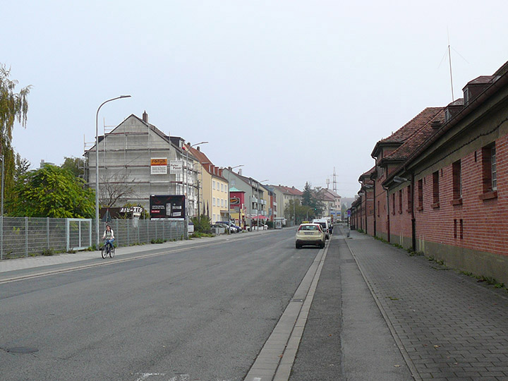
Zollnerstrasse and Luitpoldstrasse are of overriding importance as the traffic backbone between the city center and the conversion area. The design of the street spaces and the improvement of the quality of stay play an important role here. The study focuses on three in-depth areas with particular development potential.
Area A, in the rear of the train station, is the first impression of Bamberg for train passengers. Architectural solutions with high design standards are sought here, which also take into account the necessary immission control.
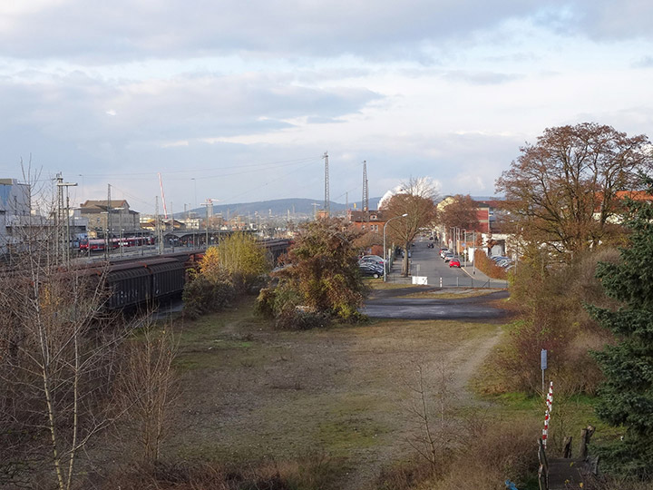
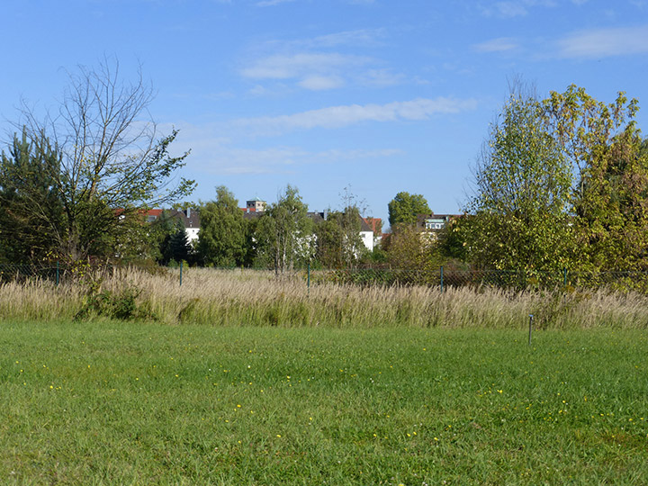
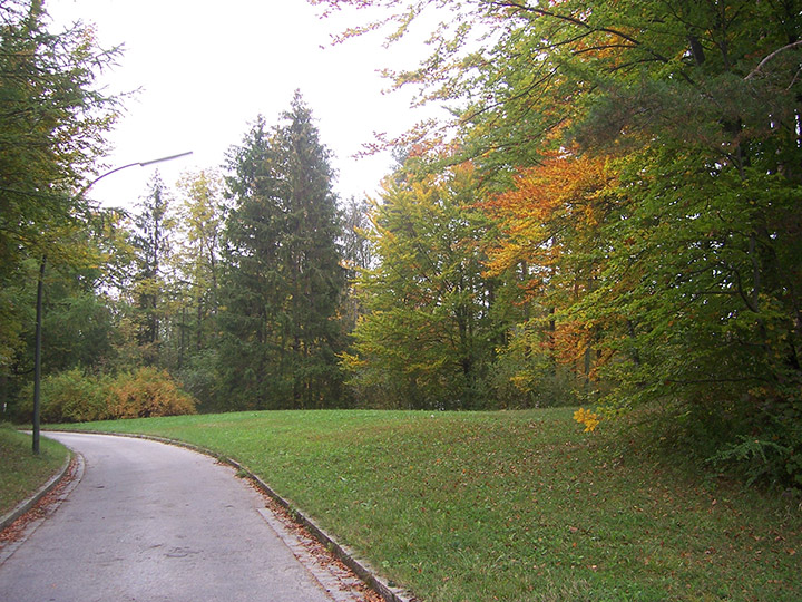
For the undeveloped and partly horticulturally used open spaces in the deepening area B, east of the railroad facilities, ideas are to be developed for the design of a green area with an integrated path connection. In addition, innovative urban development approaches are sought here for redensification at the interface between housing and commerce.
The appearance of the underused deepening area C, which is directly adjacent to the Lagarde barracks, is characterized by its location at the intersection of two main traffic axes. Gaps between buildings, brownfields and vacancies offer potential for urban upgrading and reorganization.
E13: Feldafing
Location Brief Description
Category: urban planning/landscape/architectural
Team representative: architect/urban planner/landscape planner
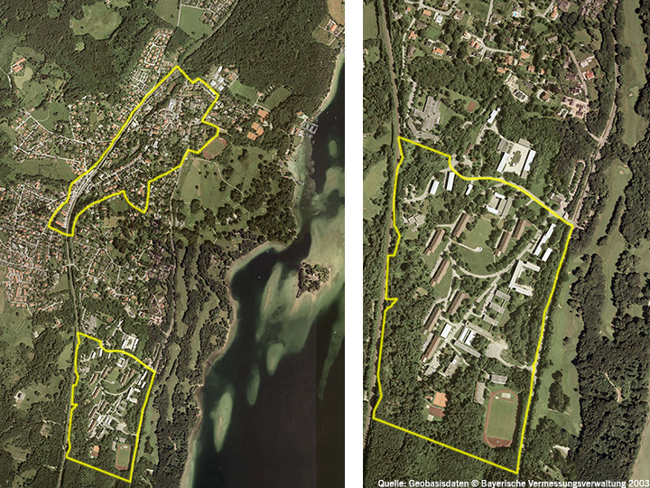
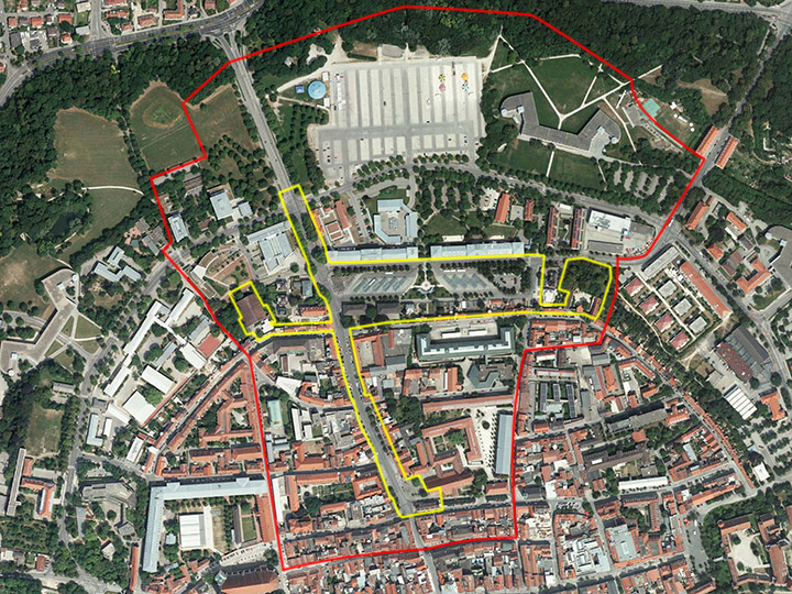
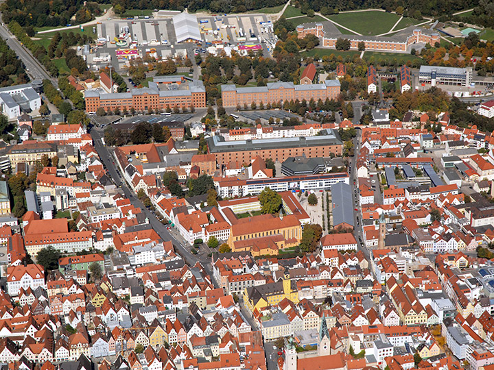
Location: Municipality of Feldafing, telecommunication school
Inhabitants: 4,100Scope: 10 km², area of the telecommunication school and linkage with the town center and the surrounding area
Project area: approx. 31 ha
Site proposal: Municipality of Feldafing
Property owner: BIm
AArt of commissioning: The results of the competition serve as impulses for a citizen participation process as a basis for further development assignments
What can the site contribute to the Adaptable City?
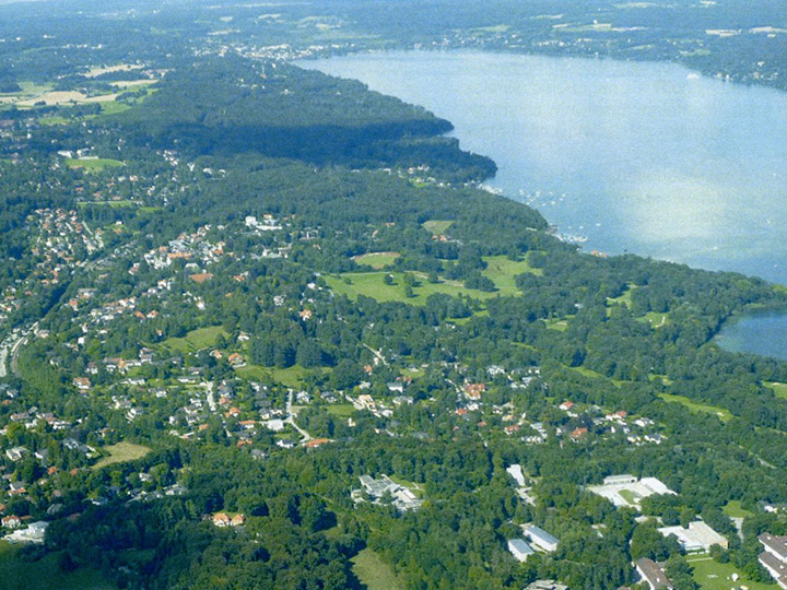
The community of Feldafing is idyllically located above Lake Starnberg. Landscape characteristics include the Lenné Park, the lakeshore and the Rose Island in the east and striking, topographically shifting landscape structures in the west. In terms of urban development, however, Feldafing today exhibits design and functional deficits, which are to be countered by targeted intervention with redevelopment and utilization concepts. An outstanding example is the reprogramming of the formerly vacant station building into a town hall with a civic hall. The relocation of the telecommunications school to the south and the availability of the 31-hectare site offer a unique opportunity to create new impulses that can have a positive impact not only on the site itself, but also on the town center and the surrounding area.
Strategic goals
In order to use and further develop the great potentials of the area of the telecommunications school, the municipality already started a discussion on a mission statement in 2001. In 2006/2007, a citizen participation process took place in which questions of socio-economic development and urban and architectural design were discussed. The result envisaged a campus model for educational, scientific and research facilities with complementary functions that would preserve the park-like character of the site despite building densification. Better path connections should also promote a revitalization and functional addition to the town center. In order to validate and, if necessary, update the results from back then, the municipality conducted another citizen participation in 2015, the results of which are to serve as impulses for Europan.
Location
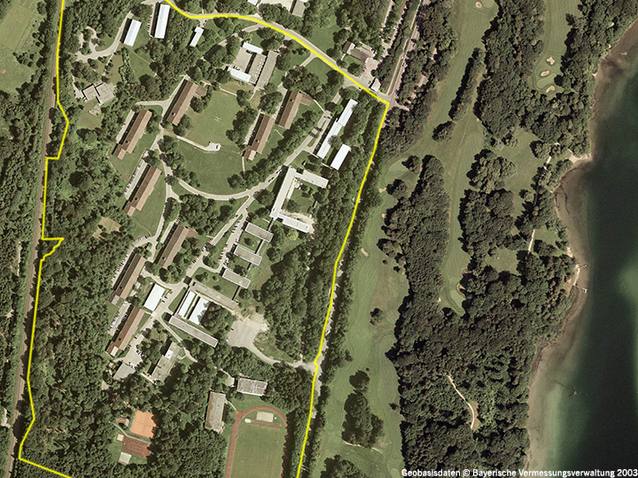
The area of the telecommunications school is located in an exposed position about 70 m above Lake Starnberg. To the west it is bordered by the railroad line, to the east by the busy Tutzinger Straße, which separates the site from the Lennépark with its golf course, a natural landscape that has grown and been preserved over 90 years, and the lake. The S-Bahn station and the town center are within walking distance. The low building density gives the area a park-like character. The development has evolved over seven decades and refers to the eventful history of the area. Individual buildings are worth preserving and convey the atmosphere of the area. In addition to accommodation buildings, teaching halls, training rooms and administrative buildings, there are buildings for sports and community facilities as well as technical halls.
Site-specific relationship to theme and site category
The site was originally developed as an elite school for the National Socialists, which is still commemorated today by the eight storm block houses built in the Alpine style. With the arrival of the German Armed Forces in 1960, the majority of today's existing buildings were constructed in the classical modern style. Over the decades, individual buildings in different architectural styles were added. With the departure of the telecommunications school, there is now an opportunity to break up the isolated location of the site and integrate it into the urban, landscape and functional context of Feldafing. To this end, connections to the lakeshore, the town center, and the newly designed train station must be developed, and solutions must be found to mitigate the barrier effect of the railroad tracks and the state road. Also important are the landscape references (visual axes), which have been lost over the years due to wild growth. On the architectural level, it is necessary to weigh which buildings and structures are suitable not only to accommodate new uses, but also to preserve the history and the special atmosphere of the site and at the same time, looking to the future, to create an open place for future generations. The goal is to bring a combination of uses from the areas of work, living, leisure and recreation into a balanced relationship. Examples are: innovative business (with a tendency towards research and development, start-ups, small and medium-sized enterprises), health and social facilities, art and culture. The search is on for an overall urban development concept that proposes program modules, identifies new construction and redensification potential, and creates a unique place for citizens, the community and the region that can be used in a variety of ways.
E13: Gera
Location Brief Description
Category: urban planning/landscape/architectural
Team representative: architect/urban planner/landscape planner
Site: city center, Breitscheidstraße Ost
Inhabitants: approx. 95,000
Scope: 13 ha
Project area: 5.27 ha
Site proposal: City of Gera / IBA Thüringen
Property owner: City of Gera and municipal housing association GWB Elstertal
Type of commission: Strategic framework plan Breitscheidstraße
What can the site contribute to the Adaptable City?
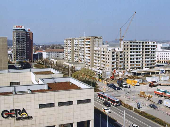
Innovative ideas and radical concepts are sought to revitalize the project area in the city center and develop it into a mixed inner-city neighborhood. Within the framework of Europan 13, different ideas for use and design are to be formulated experimentally for the wasteland on Breitscheidstrasse and the Culture and Congress Center in order to express the continuing need for change in the city's self-image. The quality of the future public spaces is of particular importance. In the sense of an interactive process of urban development, the competition participants are invited to take part in the discussion with the local actors and to design the development framework for Gera's Starke Mitte together with them.
Strategic goals
Against the backdrop of massive economic structural change, loss of importance and population decline since the social upheaval following German reunification (minus 40,000 inhabitants from 1990 to 2013), the overall urban area now appears to have become too large for Gera. The development of the economy and the city center have top priority in the city-wide goals. Participation in the International Building Exhibition (IBA) Thuringia and Europan13 is intended to overcome the mental and urban stagnation in the center of Thuringia's third-largest city. The project area and its surroundings are to become the visible site of a downtown turnaround to get the city's heart beating stronger.
Location
The project area has been a large brownfield site in the center of the city for over 15 years as a result of demolition measures. Despite its importance for the city center, it has not been possible in recent years to initiate a spatially and functionally quality and at the same time economic development here. In addition, the 1,700-seat culture and convention center raises questions about future use and entertainment. In addition, the project area is bordered by buildings from the 1970s and two large shopping centers from the 1990s. To the east, it is flanked by the ten-story Handelshof and Schloßstraße. Today's city museum in the southeast is the only surviving building reminiscent of the baroque city expansion from the 18th century.
Site-specific reference to theme and location category
Openness and flexibility
The inner-city wasteland could not be developed for more than 10 years despite planning, investor competition and marketing campaigns. However, the goal of revitalizing the project area in terms of urban development has not been abandoned. Not least because the citizens themselves provided the impetus for developing ideas for the area as part of the IBA Thuringia. It should be noted that there is little investment in Gera as a whole, the declining population does not generate any functional needs, and purchasing power is not increasing. The urban development intentions must therefore do without the usual development drivers. Building and utilization ideas must be suitable for attracting different players.
Concepts must be flexible and take into account the openness of the overall process. Therefore, a development proposal can be useful in different stages, such as temporary use and appropriation, subdivision and structuring, design and construction.
Claim as a strong center
The project area should be developed into a livable and functionally mixed inner city quarter according to the will of the citizens and the city of Gera. This should be taken into account in the proposals for programming and parcelling the area. In order to live up to the claim of being the strong center of Gera and for networking with the adjacent urban areas, the typology and quality of the public spaces also play a decisive role.
E13: Ingolstadt
Location Brief Description
Category: architectural / urban planning / landscape architecture / traffic planning / sociological
Team-Representative: architect / urban planner / traffic planner / landscape architect
Location: northern old town
Inhabitants: approx. 130,000
Consideration area: approx. 42 ha
Project area: 6.4 ha
Site proposal: City of Ingolstadt
Property owner: City of Ingolstadt, Free State of BavariaType of commission: urban master plan / preliminary project
What can the site contribute to the Adaptable City?
The primary goal is a sustainable and resource-saving strengthening of the old town. The aim is to find sustainable answers to questions of mobility, frequency, publicity and sustainability in the sense of creativity, health and public welfare in order to counteract the threat of monostructures and trading-down effects. A concept is sought that involves different actors from all social and age groups in the use of spaces, creates an identity for the place, and allows for a mix of uses in line with needs. The aim is to further develop the old town as a historically significant urban space and to create an adaptable living space that can adapt to the changed and ever more rapidly changing conditions.
Strategic goals
Ingolstadt pursues the urban planning model of a compact city, based on the historical, natural and traffic conditions. The historic Old Town with its diversity forms the center and cultural hub of Ingolstadt. With the goal of inner development, the identity and the experience value of the city are to be improved, the function of Ingolstadt as a regional center is to be strengthened and the resource land is to be used sparingly. Strengthening Ingolstadt's center as a residential location also means creating an attractive environment and qualifying the public space and establishing community-oriented uses with a cultural focus.
Location
The planning area is located in the center of Ingolstadt and marks the northern entrance to the historic old town. The area under consideration comprises the northern old town area along Harderstrasse and the intersection area Oberer Graben from Harderbastei via the Central Bus Station (ZOB) to Wunderlkasematte on Unterer Graben. Characteristic for this old town quarter is a closed perimeter block development with mostly gabled buildings and two to three full stories. The small-scale medieval building structure is partially interrupted by large-scale listed military buildings such as the Harderbastei and Wunderlkasematte built in the 14th century.
Site-specific reference to theme and location category
Harderstrasse, an important city access to the historic old town, is showing initial trading-down effects that are to be counteracted. Traffic access to the old town is provided via Harderstrasse at the expense of a pedestrian-friendly atmospheric street space. The focus is on configuring streets into urban living spaces, usable by all residents, and thus developing a networked mobility concept that prevents or reduces barriers. As the population is changing in terms of numbers and structure, new demands have to be integrated and a corresponding approach to public space has to be generated that meets changing conditions. In addition to the creation of a creative mobility and design concept for the public space Harderstraße, a thematic cross connection is to be created in the area Unterer/Oberer Graben for the architectural monuments Harderbastei and Wunderlkasematte via the location of the central bus station. A concept is sought that involves different actors from all social and age groups in the use of spaces, creates an identity for the place, and allows a mix of uses in line with needs, thus developing its own radiance and dynamism. In addition to the desire to upgrade the street space, the goal is to establish community-oriented uses with a cultural focus and to use existing space potential in the sense of sustainable urban development under the motto "Ingolstadt - livable 2025".
E13: Landsberg
Location Brief Description
Category: urban planning/landscape planning/architectural
Team representative: architect/urban planner/landscape planner
Location: Landsberg am Lech, Lechrain
Inhabitants: approx. 28,000
Scope: 553 ha
Project area: approx. 31 ha
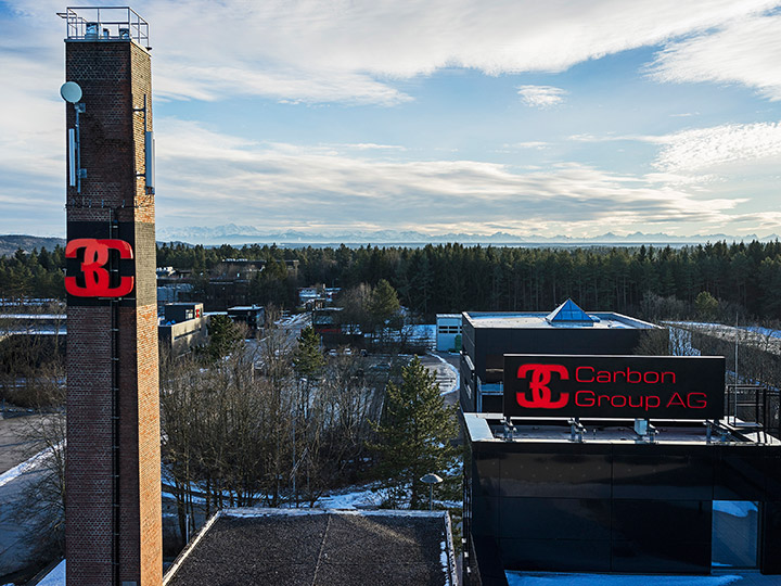
Site proposal: City of Landsberg am Lech, 3C Carbon Composite Company GmbH
Property owners: BImA, 3C Carbon Composite Company GmbH, City of Landsberg, other private owners
Type of commission: urban planning/landscape planning development concept
What can the site contribute to the Adaptable City?
Landsberg benefits from its location in the Munich metropolitan region. The state capital and higher education institutions can be reached by train and car in just 30 minutes. The Lechrain industrial park is a former barracks area - where heavy tanks were once stationed, the company 3C Carbon now develops and produces ultra-light high-tech fiber composite structures for automotive, mechanical engineering, medical technology and aerospace. Over the past ten years, the company has renovated the existing building fabric and, in combination with new buildings, adapted it to the requirements of a high-tech company. The aim of the competition is to expand the range of uses and develop the site as a leisure, residential and work location that takes account of climate protection through the use of innovative technologies.
Strategic goals
In 2011, the city of Landsberg began work on the integrated urban development concept "Zukunft am Lech," which is divided into six fields of action. This pursues the overarching goal of changing the planning culture of recent years from an inductive to a deductive direction; i.e., not reacting to given circumstances, but planning in advance in such a way that logical - positive - consequences occur for Landsberg and its citizens. Thus, a different management structure of urban development can and should emerge. The focal points for the competition area are the fields of action "traffic and mobility", "economy, trade and inner city", "green and open space structure", "energy and environment" as well as "housing and settlement structure".
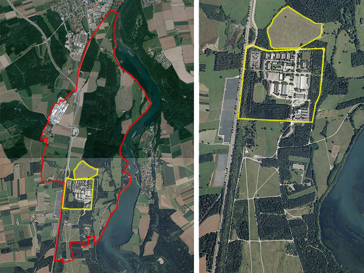
Location
In the center of the area under consideration is the Lechrain industrial park, which is largely owned by the company 3C Carbon. In the southern and eastern areas of the area under consideration are high-quality ecological areas designated as FFH areas, including the Lech River as a recreational area. Adjacent to the north are areas of forest and meadows that could be developed in the long term. To the west, the area is bordered by the federal highway 17, which connects the city center of Landsberg, about 5 km away, to the north. The business located in the area of the former barracks is growing - the directly tangential natural areas are protected. How can these diverging land functions coexist, adapt to each other and even complement and strengthen each other?
Site-specific reference to theme and site category
The goal is to make the outstanding landscape areas experiencable for people without disturbing the ecological balance. For the northern area, the vision is to take up the philosophical approach of the factory settlements and transform it into today's world, in addition to complementary uses from the health, social and sports sectors. A sustainable quarter is to be created that relies on technical innovations as well as on building and floor plan typologies adapted to very different living and lifestyle styles. With complementary infrastructures, a holistic organism in the campus spirit is to be created. Can entrepreneurs solve the problem of the shortage of skilled workers and the lack of affordable housing and, analogous to the factory settlement ideas of the 19th century, bind their employees to the places of work by offering attractive housing close to the company? Can high-quality architectural and urban planning support a recruitment of skilled workers? These questions are related to changing work, living and lifestyle patterns and must be considered integratively, taking into account numerous fields of action such as energy and the environment or mobility. Can an energy control cycle be achieved on the site through better, forward-looking planning, and can energy resources be obtained, consumed and recycled on site? How can such a settlement be designed in the midst of high-quality nature conservation and landscape areas? Can this lead to an interesting sustainable interaction of the different utilization areas?
E13: Marl
Location Brief Description
Category: urban planning/landscape planning/architectural
Team representative: architect/urban planner/landscape planner
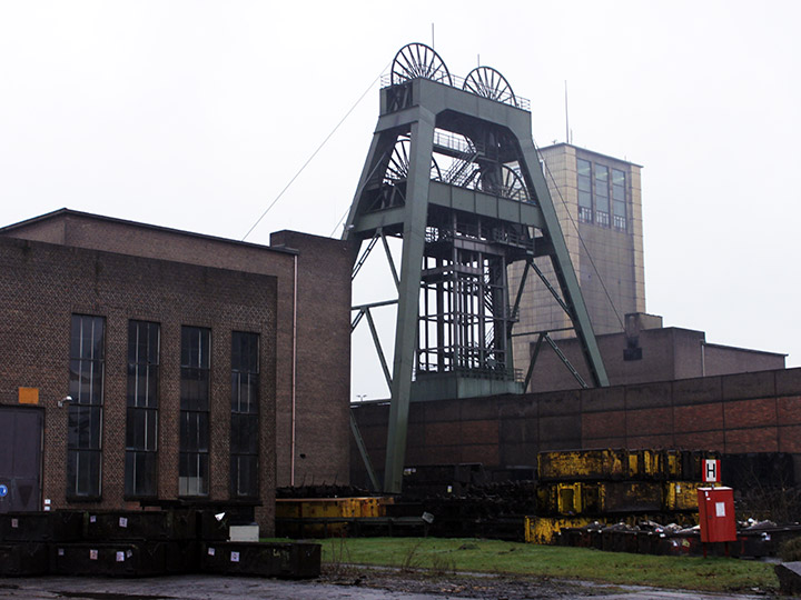
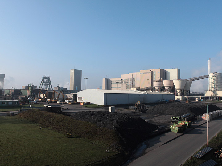
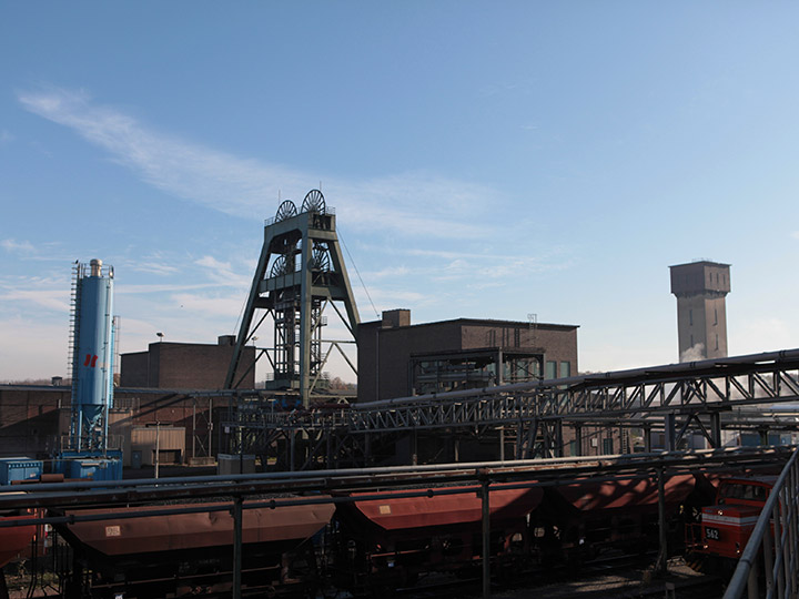
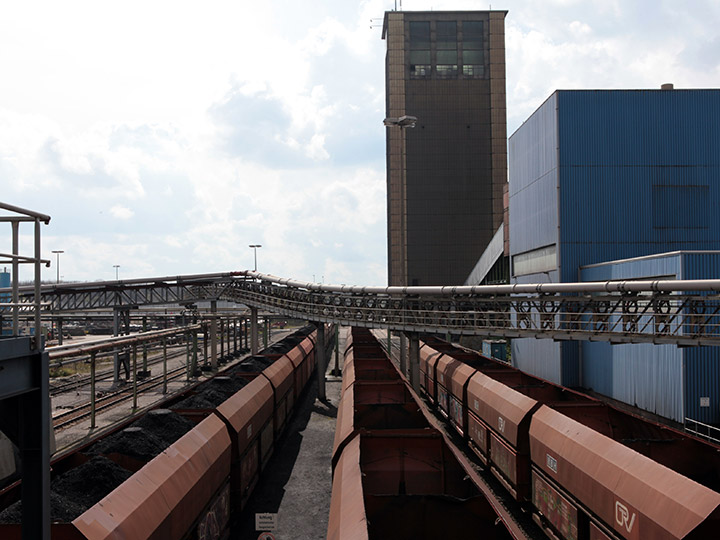
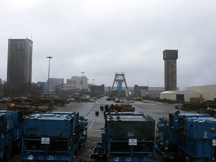
Site: Auguste Victoria Colliery, Shaft 3/7
Inhabitants: approx. 86,000
Scope: Auguste Victoria Colliery/adjacent areas
Project areas: approx. 90 ha, A 44.8 ha, B 15.0 ha, C 17.8 ha, D 11.8 ha
Site proposal: RAG Montan Immobilien GmbH
Property owner: RAG AG
Type of commission: Urban development and landscape planning framework plan, if necessary.
What can the site contribute to the Adaptable City?
The Auguste Victoria Schacht 3/7 mine in Marl-Hamm is located on the northern edge of the Ruhr region. The mine, with an underground roadway network of 99 km, is currently still in operation, employing about 3,000 people and producing nearly 3 million tons of high-quality hard coal annually, but is scheduled for closure at the end of 2015. "Adaptable city" is a key term for urban development in the future and must be interpreted site-specifically at each location. Adapting to fundamental changes in terms of climate protection, energy efficiency, demographic development, new research tasks, changing design requirements, sensible flexibilization in upgrades, conversions and new construction requires entirely different ways of thinking.
Strategic goals
The Auguste Victoria site must be viewed in a larger context that includes the neighborhood of the adjoining chemical park to the west, the slagheaps and the harbor to the north, as well as the small-scale residential development to the east, and deals with these conflicting uses. At the same time, a development concept is to be drawn up for the colliery site itself that takes up the specific character of the area, strengthens existing potential and relates it to its surroundings. The goal is to create visions at an early stage in order to present a variety of ideas - among them quite unconventional ones - for the year of closure 2015 in the discussions that will then begin about the planning procedure.
Location
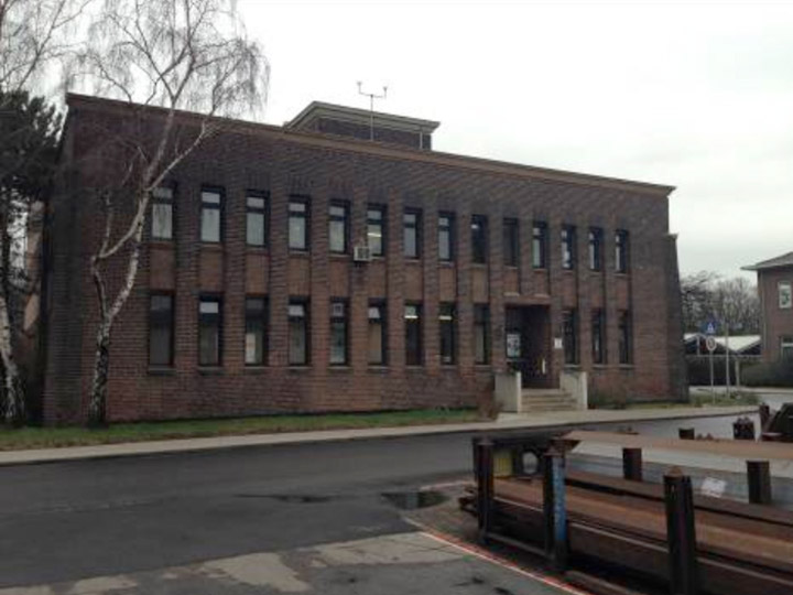
The wider surrounding area of the Auguste Victoria 3/7 colliery is characterized by the neighborhood of the Marl Chemical Park, the coal port on the Wesel-Dattel Canal, two major spoil heaps, established residential areas and the nearby passing highway. The transition to the open landscape is, in accordance with the characteristics of the Münsterland, a rather flat meadow and pasture landscape, interrupted by hedges and small woods. The Auguste Victoria mine went into operation in 1905 with shaft 1. Today, the site is characterized by buildings from many decades, which were erected to meet demand and are of little quality. Only the large mixed-use hall in the center of the site is to be preserved - as a scientific depository for large objects of the mining heritage - and used for research purposes.
Site-specific reference to theme and site category
The mine is currently the second largest employer in the region and is recognized above all as an important trainer and is therefore crucial to the economic strength of the surrounding area. In order to compensate as far as possible for the jobs lost as a result of the closure, the city of Marl and RAG have agreed on a follow-up use for AV 3/7 by trade and industry. The Marl Chemical Park, which is located immediately to the west, is one of the largest employers in the region. The subsequent use of the AV 3/7 mine is in no way intended to restrict the chemical park's production operations. Commercial and industrial use therefore has top priority. Thanks to the trimodal connection, the AV 3/7 site has good prerequisites for development as a commercial and industrial area. The site offers the opportunity to develop ideas on how industry and commerce could look under the parameters of sustainability, resource protection, energy efficiency and flexibility as well as rapid adaptability to new uses. The aforementioned quality requirements - characteristics of modern planning that are universally recognized as consensus in the residential, office and real estate sectors - have so far been neglected in the development of commercial and industrial areas. The site calls for open-minded thinking and is a creative challenge. The question is how a utilization orientation of trade and industry, which has not yet been thought out in detail today, could look like in the future. What are the design, functional and programmatic requirements for a commercial and industrial area of the 21st century?
E13: Schwäbisch Gmünd
Location brief description
Category: urban planning / landscape / architectural
Team representative: architect / urban planner / landscape planner
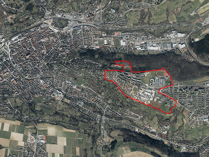
Location: Hardt district
Inhabitants: approx. 59,700 / Hardt approx. 2,900
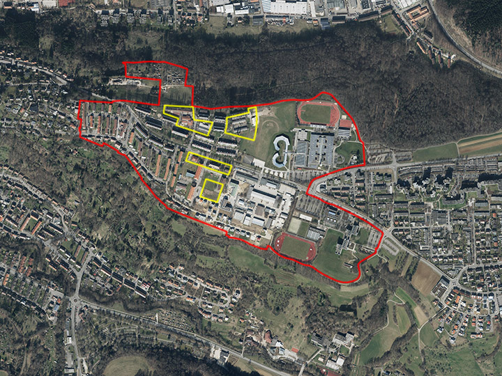
Consideration area: approx. 57 ha / idea part 8 ha
Project areas: A 1.18 ha, B 1.20 ha, C 0.67 ha, D 0.56 ha
Proposed location: City of Schwäbisch Gmünd
Property owners: City of Schwäbisch Gmünd, Vereinigte Gmünder Wohnungsbaugesellschaft (VGW), Selbsthilfe Vermietungsgenossenschaft eG (SVG), district, state, private owners
Type of commission: Integrated urban development concept with realization modules for construction areas A - D and ideas section.
What can the site contribute to the Adaptable City?
The city of Schwäbisch Gmünd has been striving to upgrade the Hardt (barracks conversion) for some time and has developed an initial master plan with a development and open space concept that provides for a reorganization of the area in parts. Within the framework of Europan, the areas of the educational university in the southeast and the vocational school center in the northeast will be included in order to explore synergies and develop ideas for a new urban model for the knowledge society of the 21st century: The existing building structures of the university are to be supplemented by new offerings, thus generating social and cultural diversity in the neighborhood. A lively district with diverse uses and its own atmosphere is to be created; with public spaces that promote encounters and understanding and provide orientation and security for the residents.
Strategic goals
An integrated urban development concept was created for the entire city with "Gmünd 2020". The Hardt area as a future urban renewal area is closely interlinked with the overall urban development plans (urbanization strategy). Between the Hardt-South and Hardt-North areas, Oberbettringer Strasse forms an urban development caesura, which is reflected in the population structure and the lack of connections between the two areas. An important linking element between the northern and southern areas in the master plan is the "Green Belt" in the form of green paths and recreational areas, which are intended to link the neighborhoods more closely across the street. The planning elaboration of the "Green Belt" and the adjacent development is an essential aspect of the competition. The Esplanades North and South are also intended to reorganize the neighborhoods in themselves and to connect the educational locations.
Location
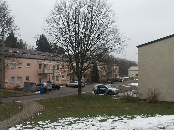
The site is located southeast of the core city on a mountain spur. The southern edge of the slope is predominantly built up with individual houses. To the east, the areas of the educational university (Pädagogische Hochschule) and the vocational school center are adjacent. In the land use plan, the area is designated as residential, public and special construction areas. The former housing area of the U.S. armed forces in the northern area is characterized by fanning out east-west oriented row buildings. The area around the elementary school and the kindergarten is to become the social center of the neighborhood in the future with supplementary social facilities and, if necessary, shopping opportunities. In the southern area, the north-south oriented row buildings from the 1950s and 1960s form an independent quarter compared to the adjacent single-family house development.
Site-specific reference to theme and location category
Conceptual, urban planning and design solutions are to contribute to strengthening the identity of the Hardt. An improvement of the integration and the creation of a social balance of Hardt-South and Hardt-North by upgrading the housing stock and the residential environment as well as the creation of new, contemporary living space play an essential role. A superordinate overall urban and landscape planning concept for the area under consideration is sought, which sets new impulses for a better networking of the areas and an inclusion of the existing educational institutions in the overall concept. Within the project area, special importance is attached to the "Green Belt" and the esplanades as networking elements between the future neighborhood center (with the adjacent Weltgarten to the northeast, an initiative of the citizens of Gmünd to enhance the multicultural district), the planned Angerbebauung to the north and the Sonnenhügel residential district to the south; in the medium term, the former building yard area offers potential for an integrated university city and is an essential building block of the ideas section. Concrete architectural proposals are expected for the building fields. The center structure of the area with regard to retail between Falkenbergplatz, the neighborhood center and the new university city is to be readjusted. An essential task is also a qualification of the residential environment: redesign of streets and squares as well as proposals for the reorganization of stationary traffic. The barrier effect of Oberbettringer Straße is to be reduced by design measures and the current character of a pure thoroughfare is to be clearly counteracted. The aim is to achieve a sustainable development of the Hardt that takes equal account of social, cultural, ecological and economic concerns, safeguards urban development qualities and takes account of climate protection through the use of innovative technologies.
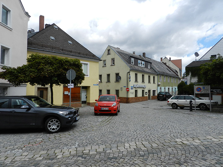
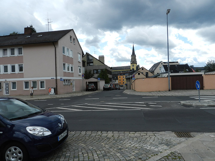
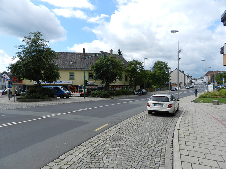
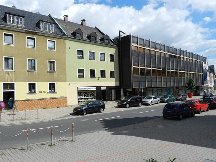
E13: Selb
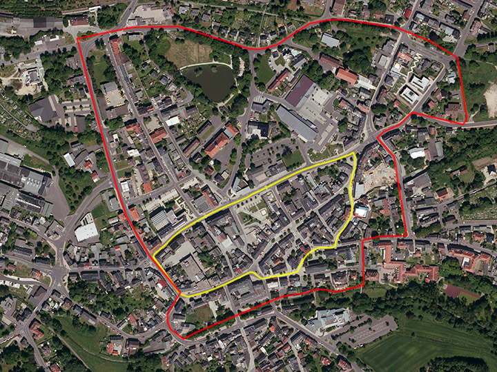
Site Brief Description
Category: urban
Team representative: architect/city planner/landscape planner
Location: Downtown
Inhabitants: ca.15,000
Scope: 5.14ha
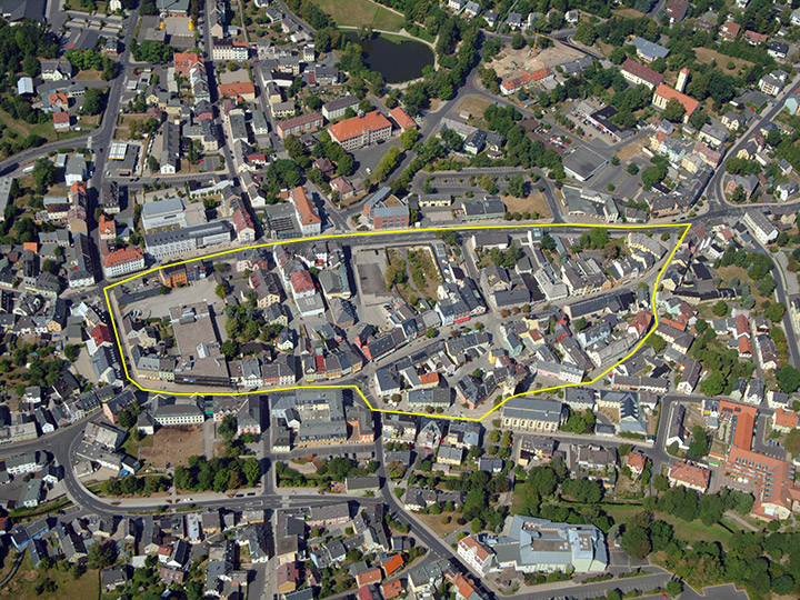
Project area: 2.88ha
Proposed site: City of Selb
Property owners: predominantly private owners, individual properties owned by the City of Selb
Type of commission: urban master plan.
What can the site contribute to the Adaptable City?
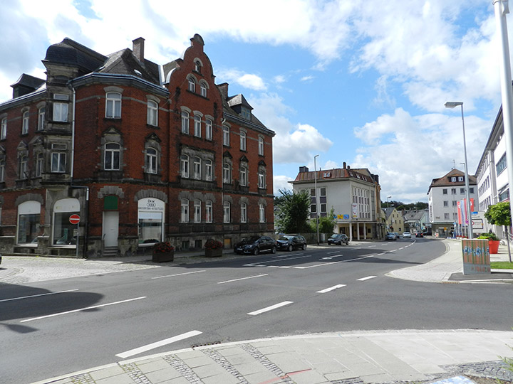
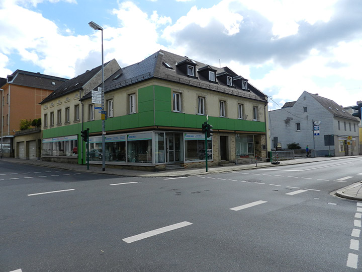
Due to the structural crisis in the local economy, which was previously dominated by the porcelain industry, and regional demographic trends, the city of Selb is continuously shrinking and has lost a quarter of its population since the late 1970s. As a result, the city center in particular is also undergoing major changes. Long-established businesses are unable to find successors and are giving up their use, and due to the lack of attractive residential locations, residents are moving to the outskirts of the town. Commercial and industrial wastelands characterize the cityscape, as do undesigned open spaces. Traffic routing is in some cases inconclusive and places a high burden on the built-up neighborhoods. An adaptation to the changed parameters is indispensable.
Strategic goals
The basis is the target system formulated in the integrated urban development concept of the city of Selb with the focus on sustainable urban development taking into account demographic and economic conditions. The city center as a location is to be strengthened and developed as a priority. Diversity of use and liveliness must be strengthened through a wide range of activities, and urban planning mistakes must be corrected. The urban context of living, working, supplying and culture must be made attractive again. It is therefore necessary to revitalize vacant properties by using all available instruments. The city of Selb strives for a networking of all disciplines in the urban society. Social, cultural and economic practices play an important role in the implementation.
Location
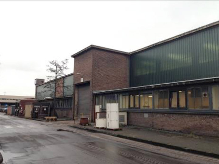
The area under consideration includes the extended city center in addition to the core city. The area is bounded by Geschwister-Scholl-Strasse in the north and by the Sedanstrasse, Obere Bergstrasse axis in the east. The entire area is heterogeneously built, comprises a conglomerate of the most diverse building forms from different construction periods, and exhibits a number of urban development deficiencies. The existing residential, commercial and service uses have partially lost their function. Gaps between buildings often provide a view of unattractive backyards and outbuildings. Many owners do not have the financial means to adequately maintain their buildings. One example is the dominant building complex of the "Storg" department store on Ludwigstrasse, which has stood empty for many years after the insolvency of a family business.
Location-specific reference to theme and location category
Within the scope of the investigations for the urban development concept, the inner city with the project area was also analyzed in detail. The necessary adaptation to the changed economic and demographic conditions was shown here. A networking of all disciplines in the urban society is aimed at, which is why social, cultural and economic practices play an important role. How the city center develops further and what sustainable new uses can be found, especially for the vacant retail spaces in the first floor zones, will be essential for the success of the adaptation. Based on the existing infrastructure, the city center is to be sustainably strengthened as an attractive residential location for all generations. The existing, partly vacant building fabric is to be included as well as a new construction of barrier-free apartments on the existing fallow land. Due to the often poor quality of the building fabric, replacement buildings are also conceivable. Innovative, cost-effective solutions are required. In the future, inner-city apartments must meet the requirements of contemporary living standards and, of course, be accessible without barriers. In this context, it is also essential to make the residential environment more attractive. In all efforts, the ecological aspect must also be taken into account, and value is placed on an appealing open space design. Attention must be paid to networking with adjacent areas.