E12: Sites
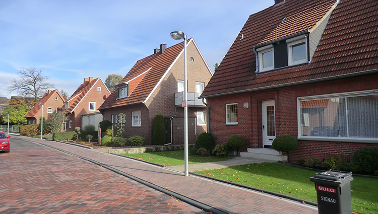
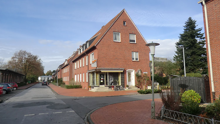
E12: Bitterfeld-Wolfen
Site Brief Description
Category: urban planning-architectural
Team representative: architect/urban planner/landscape planner
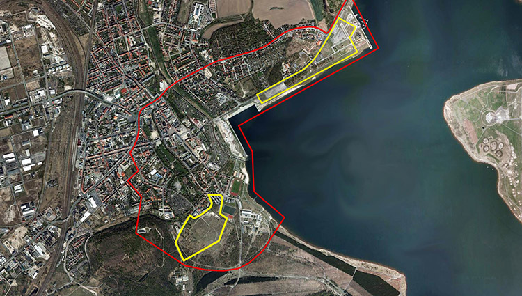
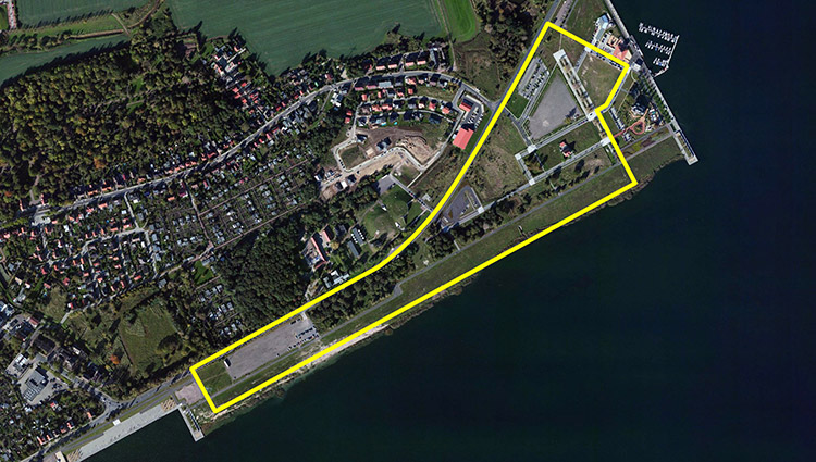
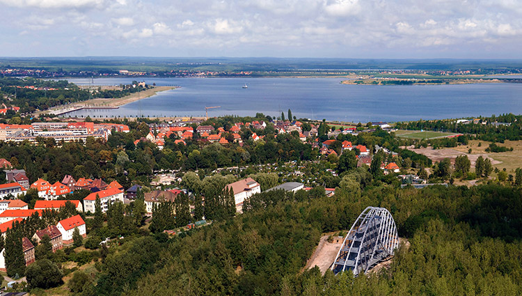
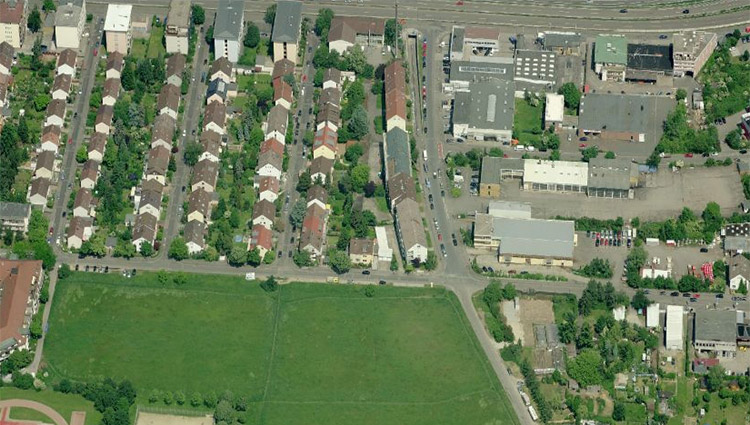
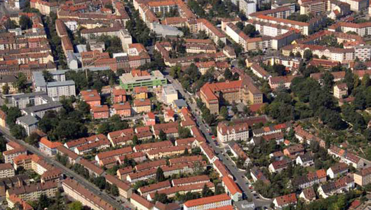
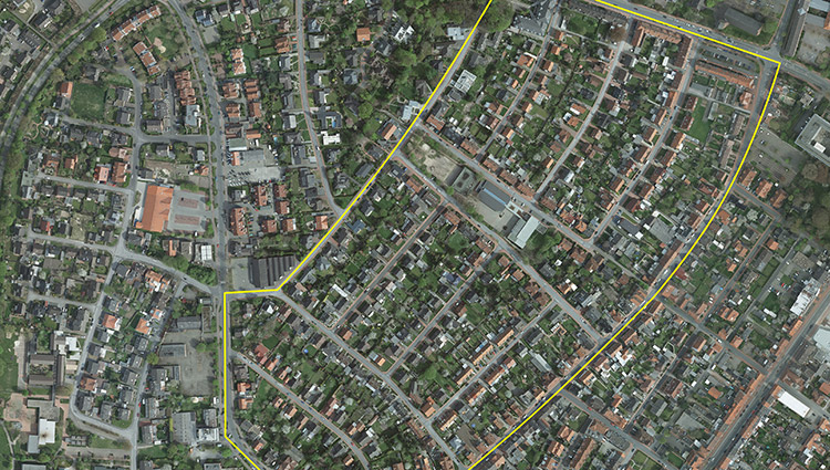
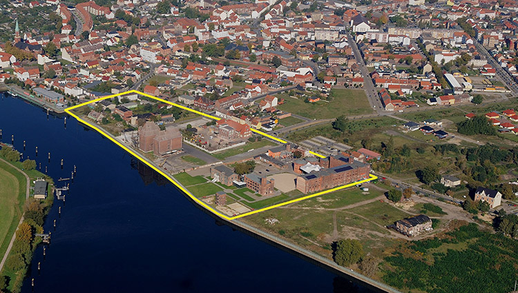
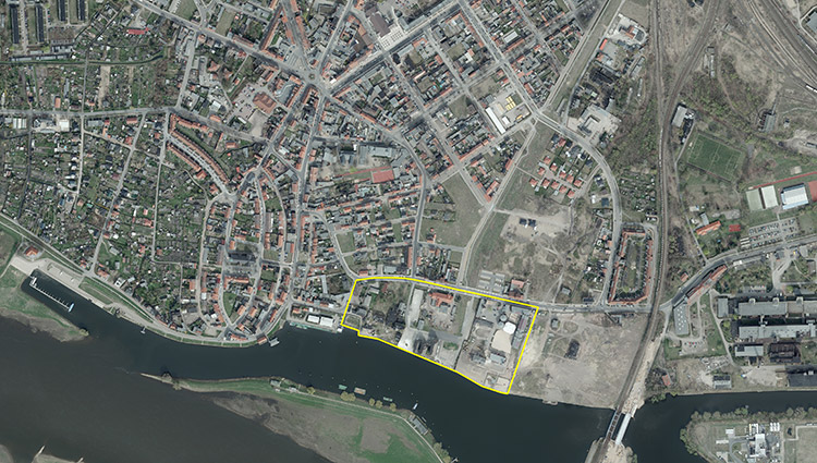
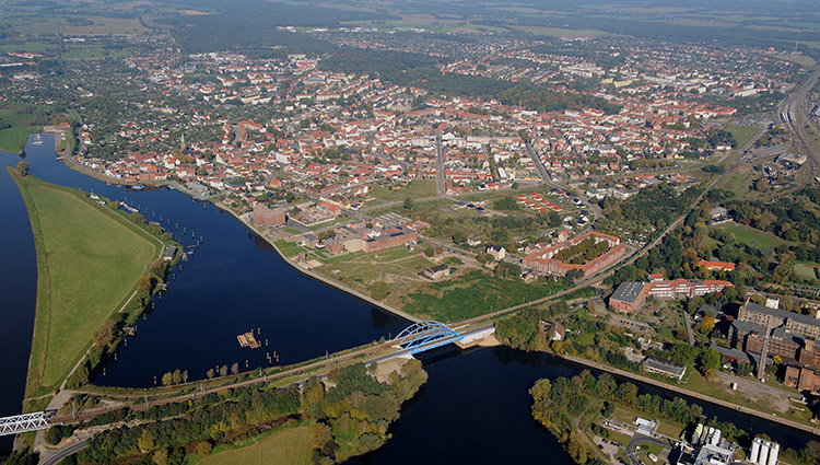
Location: Bitterfeld - Gartenstadt Süd and Stadthafen
Inhabitants: Bitterfeld-Wolfen approx. 43,900
Survey area: 269 ha
Project area: Gartenstadt Süd approx. 15.6 ha, city harbor approx. 17 ha
Site proposal: City of Bitterfeld-Wolfen
Property owners: City of Bitterfeld-Wolfen (approx. 1/3), LMBV (approx. 1/3), private owner (approx. 1/3)
Type of commission: Urban development framework plan, if necessary individual construction projects
Adaptable City - Thematic Framework
The former chemical region of Bitterfeld-Wolfen has been undergoing fundamental structural change since 1990. With the newly created Goitzsche leisure landscape and the "Technology Park Central Germany", a successful transformation process has been initiated that is being continuously continued. The urban development connection of Bitterfeld to the city harbor of Lake Goitzsche, located in front of the city center, will be completed in the foreseeable future. The question now arises as to what urban development form and extent a reorientation of Bitterfeld's inner city can be realized with a sustainable urban expansion around the Goitzsche. The two brownfield sites in Gartenstadt Süd and at the city harbor offer development potential of outstanding importance in this context.
Strategic goals
The guiding principle of the city of Bitterfeld is the further development of the city as a complex working, living and leisure location, an aspiration to which valuable new potential has been added with the development of Lake Goitzsche. The city is thus to become not only a place to work and live, but in a new form "a place to live". This mission statement is to be implemented not only in individual (structural) measures, but also in the city's self-presentation. The reactivation of the fallow land "Gartenstadt Süd" and the area between the city harbor and the villa at Bernsteinsee offers the opportunity to create new residential typologies and attractive sports, leisure and recreation concepts that go beyond the previous offerings in terms of quality and appeal and attract new residents.
Site description
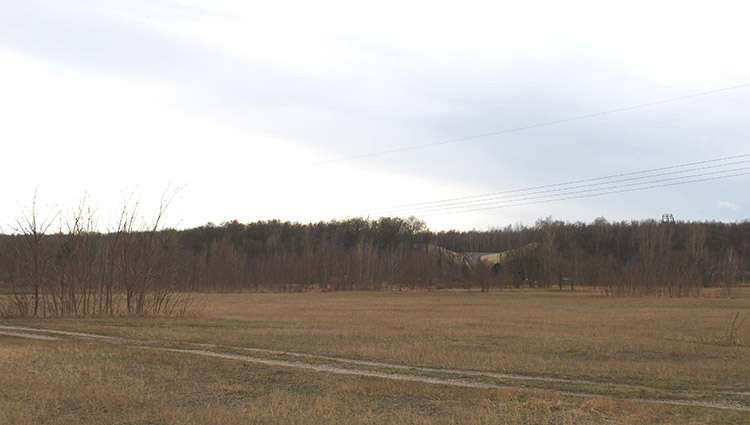
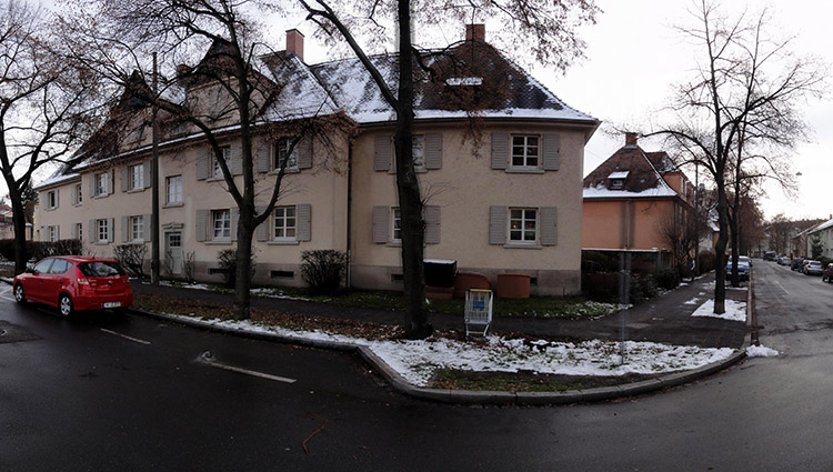
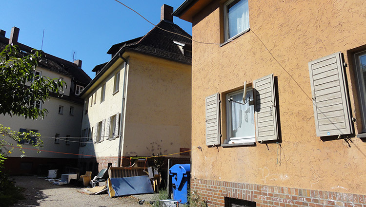
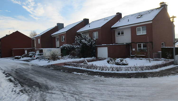
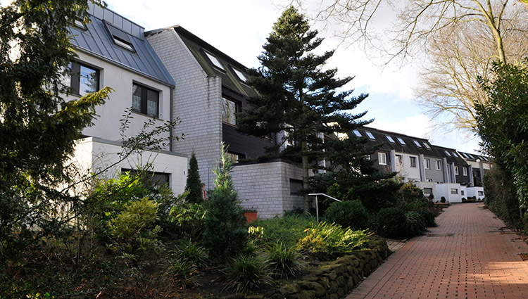
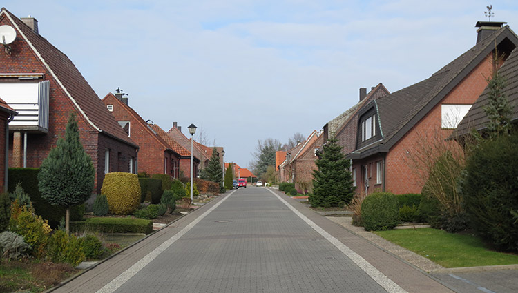
The brownfield site "Gartenstadt Süd" is located in the southern outskirts of the city, which is characterized by suburban development and partly villa-like residential buildings. The proximity to Bitterfeld's city center (800 m), to the city beach of Lake Goitzsee (600 m) as well as to the city park "Grüne Lunge" (Green Lung) and to the Goitzsee Forest represent a special potential. The area is currently being developed by a new road construction. The tourist development of the Goitzsche into an interesting local recreation area is moving this area into the focus of urban development. The project area "Stadthafen" is located at the southern edge of the suburban residential area "Auensiedlung" and is separated from it by the federal highway B 100. In the land use plan, sports/recreation and green space are designated as uses.
City in transition: essential elements
Bitterfeld-Wolfen is the medium-sized town with the strongest industry in the district and, with the Goitzschesee lake, which has been flooded since 2002 and is now known beyond the region, and the Goitzschewald forest, has a wide range of local recreational opportunities and scenic qualities. Nevertheless, the city has to contend with the shrinkage phenomena of demographic and economic structural change. With the further development of the city as a complex working, living and leisure location, the city wants to attract new target and resident groups in the long term. To this end, offers of new and intergenerational forms of housing must be strengthened and alternatives to the classic construction of single-family homes on greenfield sites must be demonstrated.
The new approach is to develop house and apartment typologies that have a strong relationship to the landscape and offer infrastructural prerequisites for families with an affinity for sports. On the one hand, the public (green) spaces should retain their landscape character, but also promote identification with the residential quarter and the Goitzsche Forest in the sense of meeting places. The direct connection of living with leisure and local recreation functions should increase the attractiveness. For the location of the city harbor, on the other hand, the development focus is to be placed on a wide variety of uses with attractive leisure and recreational spaces with reference to the water, whereby the intention here is above all to sharpen the profile of the "Goitzsche" tourism location as a whole and to strengthen it in the long term.
E12: Donauwörth
Site Brief Description
Team representative: Architect/urban planner/landscape planner
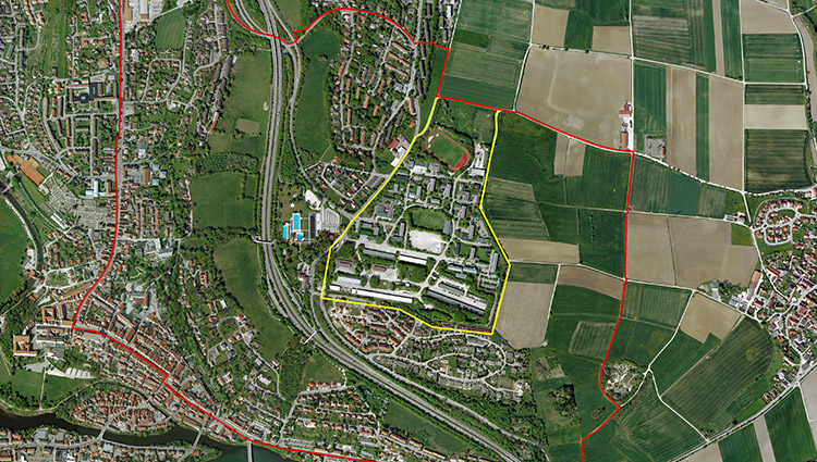
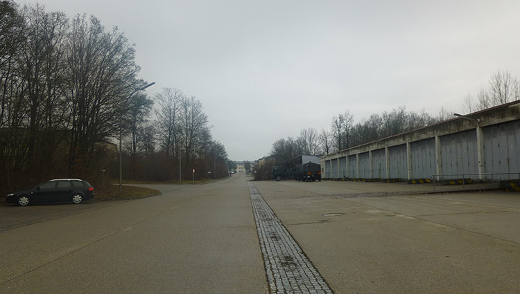
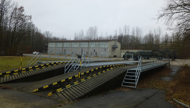
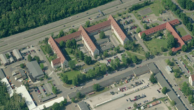
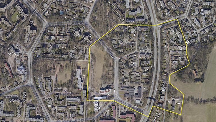
Location: Donauwörth - Alfred Delp Barracks
Inhabitants: Donauwörth 18,300
Scope: approx. 245 ha
Project area: 30 ha
Proposed location: City of Donauwörth
Property owner: Federal Republic of Germany (BImA), acquisition of the land by the City of Donauwörth is under consideration
Type of commission: Urban development framework plan
Adaptable City - Thematic Framework
In the course of the upcoming Bundeswehr reform, the city of Donauwörth was informed in October 2011 that the Bundeswehr base in Donauwörth will be reduced to such an extent that the area of the former Alfred Delp barracks, which is located in the Parkstadt district, will no longer be needed for Bundeswehr purposes. It is expected that the last Bundeswehr soldiers will be withdrawn from the site by the end of 2013. For this reason, the city of Donauwörth is faced with the question of the subsequent use of the barracks site. To what extent can existing buildings be put to new uses? What new structures can be developed if existing buildings have to be demolished?
Strategic goals
The main urban planning objective is to link the vacated military site with the adjacent Parkstadt and the Schellenberg housing estate. In addition, the connection of the area to the old town is to be improved. A lively urban quarter for living and working is to be developed, which in its development is energy-saving, ecological, intergenerational and oriented towards local recreation and leisure. Ideas and concepts for this are to be found within the framework of the Europan 12 competition. A robust overall concept is sought that allows for phased development.
Location
The Alfred Delp barracks are located on the Schellenberg, a foothill of the Jura mountains. It is located about 100 meters above the core city of Donauwörth and covers an area of about 30 hectares. The competition area for the Europan 9 competition at that time is located about one kilometer northwest of the barracks area. The barracks are bordered to the south by the Schellenberg residential area and to the northwest by the Parkstadt residential area, a residential district developed on the drawing board from the 1950s to the 1970s. To the west of the barracks area, opposite the main gate, is the municipal outdoor swimming pool. Agricultural land borders the site to the north and east.
City in transition: essential elements
The competition area is to be developed as an urban quarter for living and working. Due to the proximity to the open-air swimming pool and the location of the area between the single-family house area at Schellenberg and the residential area of Parkstadt, complementary uses in the areas of sports, leisure and recreation are possible. Existing buildings can also be used for new purposes. Particular attention should be paid to linking the quarter to the historic old town. The topographical situation and the separating effect of the federal highway must be taken into account. In view of the size of the area and in order to meet the demand on the Donauwörth housing market, a phased development concept should be drawn up. A robust urban development concept is required that can react flexibly to changing conditions. Analyses of the area in terms of urban planning, economics, traffic, landscape planning, demographics, and social and cultural aspects are available. These can serve as a basis for the development of alternative uses with different, even temporary scenarios. How can the area, with the inclusion of existing buildings and with an efficient connection to the old town of Donauwörth, be developed into a lively quarter that also attracts new residents with attractive offers and future-oriented residential typologies?
E12: Heidelberg
Site Brief Description
Category: urban planning/architectural
Team representative: architect/urban planner
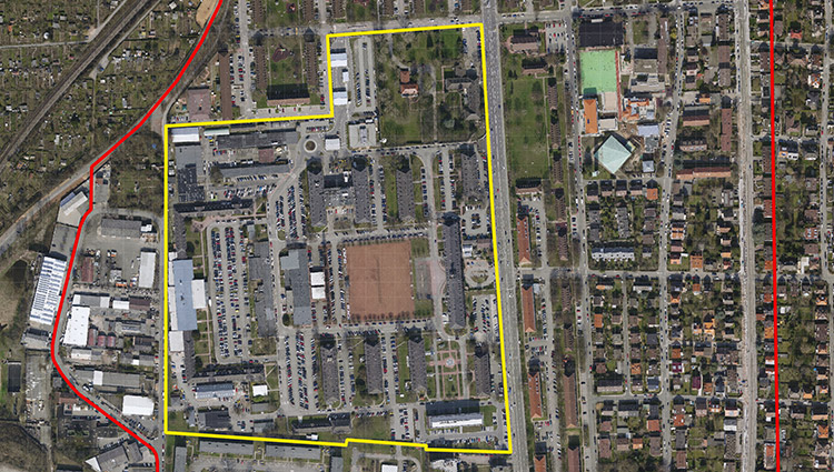
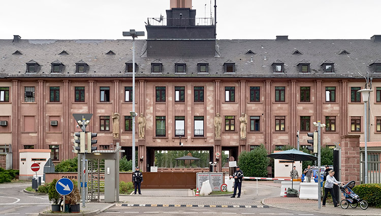
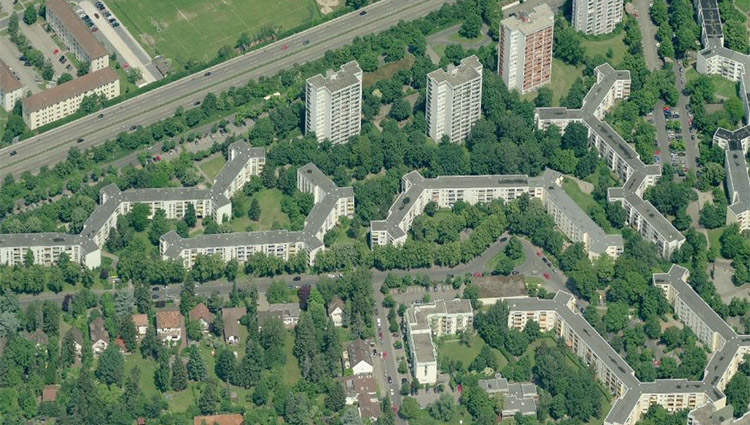
Location: Heidelberg - Campbell Barracks
Inhabitants: approx. 150,000, Südstadt approx. 4,000
Scope: approx. 80 ha
Project area: 16 ha
Proposed location: City of Heidelberg
Property owner: Federal Republic of Germany (BImA), acquisition of the land by the City of Heidelberg is planned
Type of commission: Urban master plan
Adaptable City - Thematic Framework
The Campbell Barracks, built in 1937 as the Greater Germany Barracks and occupied by the Americans after World War 2, is now the headquarters of the American armed forces. Between 2004 and 2006, the new NATO headquarters building was erected on the site, which received the "2008 Award for Good Buildings" from the Association of German Architects. With the withdrawal of the American forces and the NATO headquarters at the end of 2013, the city of Heidelberg has the opportunity to put the areas previously used for military purposes to civilian use. The aim is to develop the areas sustainably, taking into account social, cultural, ecological and economic concerns in equal measure and safeguarding urban development qualities.
Strategic goals
The city of Heidelberg's urban development concept envisages Südstadt as a development focus for residential construction. The areas used for military purposes (Campbell Barracks/Mark Twain Village) take up about one third of the area of Südstadt and clearly characterize it. South Town does not have a commercial center or central plazas as meeting places and communication platforms. In an open process that leaves room for the new and the unknown, it will be investigated with which, also temporary, uses the buildings could be reprogrammed and which function and atmosphere the large, central parade ground can assume in the future in the interconnectedness with other open spaces in South City.
Site Description
Campbell Barracks is bounded on the east by Roman Road, which has a strong separating effect. East of Roman Road and north of the barracks is Mark Twain Village, the residential neighborhood of the U.S. Armed Forces. All military installations, including the residential areas, were fenced off after the September 11, 2001 attacks. Campbell Barracks is symmetrically laid out around a large parade ground, framed on the north and south by three rows of buildings each. The western end is formed by the former stables in a U-shape; outside the barracks there is a small commercial area. The buildings between the parade ground and the former stables/horse paddock are not listed. Structural engineering ideas can be developed for this intermediate space.
City in transition: essential elements
In a transparent and open-ended process involving the public, the city of Heidelberg has developed guidelines for the total of 180 hectares of conversion areas that will be handed over to civilian use by 2015. The planning is understood as an open process - as a building block for the creation of open spaces and the promotion of innovation. Possible synergies with the IBA "Knowledge Creates City" should also be explored. Proposals are sought for innovative programs that help to open up the barracks area, which has been hermetically sealed off for decades, to Südstadt and that promote development into a diverse and lively neighborhood with a good quality of life and the courage to experiment. Proposals for the use of the existing buildings are expected, including temporary concepts to initiate the development process and thus establish new uses in the long term. The enormous open space of Paradeplatz offers the opportunity to compensate for the undersupply of open space in Südstadt. Whether this plaza can simultaneously create a new focal point for the residents of South City needs to be explored. The redesign of the area is intended to promote a diverse mix of residential, cultural, work, and recreational uses. At the same time, the east-west connection is to be strengthened on an urban climate level as well as on a neighborhood level. In this context, the upgrading of Römerstrasse to create an attractive environment and better links is of particular importance.
E12: Kaiserslautern
Site Brief Description
Category: urban planning/architectural
Team representative: architect/urban planner/landscape planner
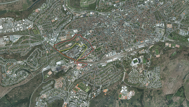
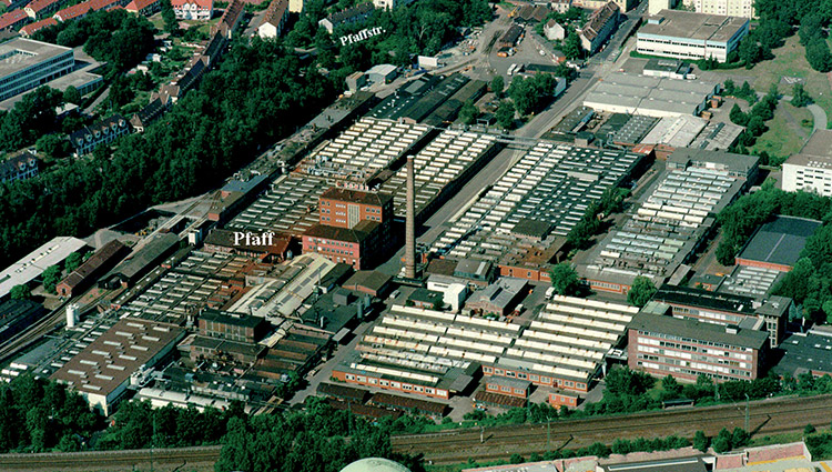
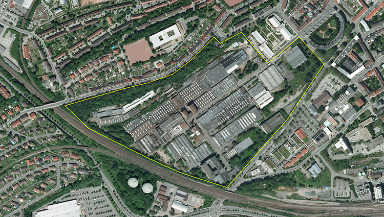
Location: Kaiserslautern, Pfaff-Area
lnInhabitants: 98,100
Scope: 54 ha
Project area: 19.5 ha
Proposed location: City of Kaiserslautern
Property owner: Insolvency administration
Type of commission: Urban development framework plan
Adaptable City - Thematic Framework
Favoured by the expansion of the railroad, the first large-scale industrial enterprises were established in the Kaiserslautern area around 1850. With the foundation of the Pfaff sewing machine factory in 1862, the city gained great economic importance. The company shrank from 9,000 employees at its peak to 250 employees today and was relocated to the outskirts of the city in spring 2010. The successive shrinkage resulted in subsequent uses in the surrounding area, which were predominantly focused on shopping markets. The relocation of the company now offers the opportunity to initiate a sustainable development of the derelict area in the context of the transformation of the industrial city of Kaiserslautern into a knowledge and technology-oriented location with a global orientation.
Strategic goals
Based on the city report "StadtTechnopole_Kaiserslautern", the plan area is to be developed as the "Technik-Pol Pfaff-Gelände". Important connecting points for the development of the area are the Technical University of Kaiserslautern, which is located to the south of the Pfaff site, with the adjacent University Park and the institutes located here, as well as the Westpfalz-Klinikum, which is located to the northeast. The development of the area is to focus on "research, laboratories, services" and "health, wellness and sports". An urban, lively location is to be developed through a mixture of uses and the integration of housing. Soil contamination requires a high degree of soil sealing as well as a vertical layout with residential uses oriented to the upper floors.
Location
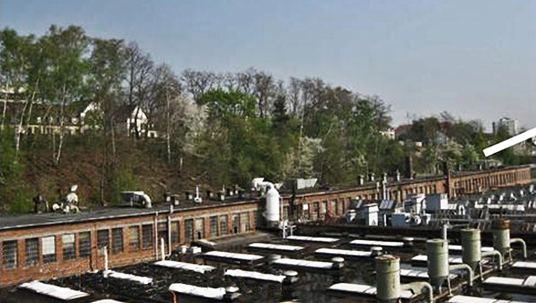
The plan area is located in the southwest of downtown Kaiserslautern. It is located close to the city center, about 1.5 km from the city center. The area is bordered by the busy Königstrasse to the south and Herzog-von-Weimar-Strasse (service road) to the north. To the west, the railroad tracks form the area's boundary. To the east, the area boundaries are formed by a psychiatric clinic, Albert-Schweitzer-Straße and Pfaffstraße. To the north of the plan area is a former Pfaff housing estate; to the east, the inner-city residential area "Rundbau" borders the plan area (monument zones). With the exception of two administrative buildings and a boiler and turbine house, the building stock on the former Pfaff site is assessed as not suitable for reuse.
City in transition: essential elements
The Europan competition is expected to produce proposals that show a continuation of the Science Mile from the Technical University via Uni-Park toward the city center, creating links both to the Westpfalzklinikum and to the adjacent residential uses in the West City Center. Due to the special importance of the site, a focus on the development of a technology site and its development in sections is to be placed. Strategies are sought to combine the building structures of institutes, laboratories and services with an urban mix of uses. Temporary uses are to be identified and checked for their compatibility with the intended end use. An attractive design of the entrance situation to Königstraße should also provide impulses for the future development of the areas to the south. The retail businesses already located here justify the exclusion of larger retail uses in the planning area. The site break located at the northern planning area offers opportunities for a greenbelt or exclusive residential use on the hillside. As part of the screening to the railroad areas to the west or the design of central parking facilities, reuse of demolition/earth materials generated in the area will be sought. The need to provide water management retention volume should be solved by a design that serves the quality of stay. The urban development uses are to be harmonized with the soil conservation redevelopment concept.
E12: Kaufbeuren
Site Brief Description
Category: urban planning-landscape planning-architectural
Team representative: architect/urban planner/landscape planner
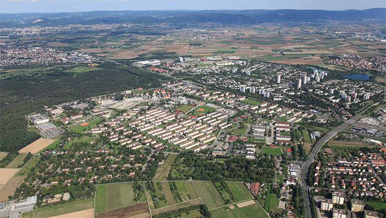
Location: Kaufbeuren - Fliegerhorst Kaufbeuren
Inhabitants: 43,100
Scope: approx. 580 ha
Project area: 230 ha
Proposed location: City of Kaufbeuren
Property owner: Federal Republic of Germany (BImA)
Type of commission: urban planning framework plan, a separate award procedure according to VOF is required for the award of a planning contract.
Adaptable City - Thematic Framework
After many years of the city of Kaufbeuren's connection with the air base, which in particular houses the Technical School of the German Air Force, the announced closure threatens a considerable loss of urban and structural function with serious consequences for the city and the entire region. The city wants to deal promptly with the resulting consequences and changes with regard to urban development, demographics, the economy, the environment and future opportunities. Only a strategic approach offers the opportunity to actively exploit the opportunities arising from conversion. The city is pursuing a combined approach consisting of infrastructure measures, sustainable reuse and cooperation models in order to cushion this substantial structural change.
Strategic goals
The conversion of the "Kaufbeuren Air Base" requires a comprehensive consideration of the areas of urban development, economy, supply, landscape, environment, demography as well as social and cultural development of Kaufbeuren. Under the motto "City in transition - start of an innovative development", the aim is to create sustainable impulses in the fields of research, education and related production areas as well as civil-military cooperation. In the sense of a campus, interdisciplinary synergies are to be created, combined with sophisticated leisure and sports facilities as well as housing. In the context of the urban development reorganization, the interconnections of the site to the city center, to the adjoining city and town districts as well as to the neighboring communities are also to be considered.
Site description
The air base, which was built between 1935 and 1938, is located in a scenic area to the south of the city, with a view of the Alpine landscape. After the Second World War, the runway was extended by approx. 500 m to a length of approx. 2200 m, into the municipal area of Ruderatshofen. The area, which today covers approx. 230 ha, is mainly built up (e.g. hangars, lecture halls, accommodation for course participants) in the northern area. The largest part of the air base is undeveloped; the runway, which has created important biotopes, is a characteristic feature of the entire area. The immediate access is via the Apfeltranger Straße, the connection to the supraregional B 12 leads through the city center.
City in transition: essential elements
In order to concretize the urban development of the "Kaufbeuren Air Base", the city council decided to carry out preparatory studies with the participation and involvement of the affected parties as well as the public agencies, in order to obtain a well-founded as well as interdisciplinary analysis and development concept. The results of these investigations are the basis for alternative uses with several scenarios, which are decisive for the future development. The area "Fliegerhorst Kaufbeuren" is to be further developed and restructured as an urban quarter. With regard to the consumption of resources and land, reorientation and change of use are to be coordinated. The adjacent surroundings as well as the consideration of the entire city must be integrated into this process. In the area under consideration, therefore, the links with the old town and the adjoining areas in particular must be examined, taking into account the topography. The aim is to integrate relevant landscape features and important elements of greenery into the urban development concept. The objectives at the urban planning and settlement structure level are initially directed towards a master plan that brings together the differentiated utilization requirements in a robust and long-term flexible urban, traffic and landscape planning structure. In the sense of "clusters", the individual areas of use can be adapted or changed in accordance with medium- to longer-term requirements. The time dimension of the process is to be taken into account with a phased development concept, which can also include temporary interim uses.
E12: Konstanz-Kreuzlingen
Site Brief Description
Location: Urban development with integrated open space and traffic planning
Team representative: Architect/urban planner
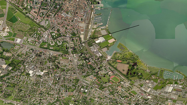
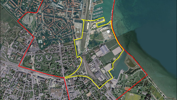
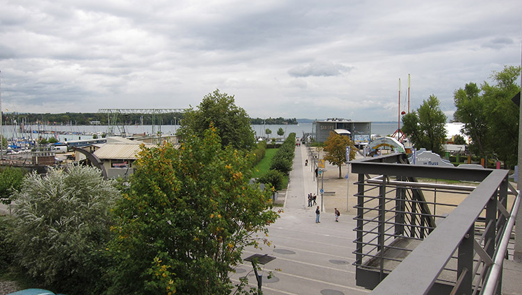
Location: Constance (D) - Kreuzlingen (CH) - Little Venice
Inhabitants: approx. 100,000 (Constance 80,000, Kreuzlingen 20,000)
Area under consideration: approx. 125 ha
Project area: 26.9 ha
Site proposal: Municipality of Constance (D),Municipality of Kreuzlingen (CH)
Property owners: Municipality of Constance (D),Municipality of Kreuzlingen (CH)
Type of commission: Urban planning and landscape architectural framework planning
Adaptable City - Thematic Framework
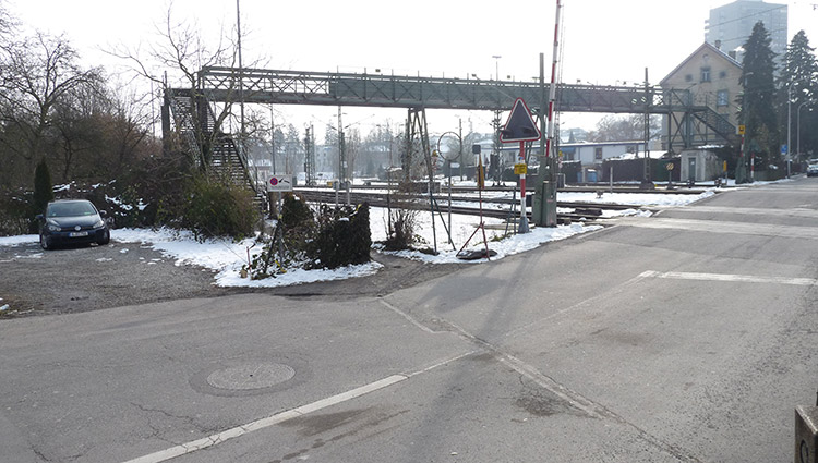
The highly frequented shore area of the two municipalities of Constance and Kreuzlingen at the western part of Lake Constance lacks a common design. The state and city borders are to be relegated to the background by means of a landscape emphasis, and the railway tracks cutting off the lakeshore area from the city centers are to be overcome. A cross-border, meaningful overall concept is sought for interlocking uses that enhance the area. A robust basic framework is to provide a long-term processual development with simultaneous flexibility in the face of possible changes in the framework conditions. Creative ideas and decision-making aids for public and political discussions are expected in the finding process of both communities, after earlier joint development concepts failed.
Strategic goals
Within the overarching framework of the Constance- Kreuzlingen agglomeration program, "STEP Zukunft 2020" and other location-related municipal and city council resolutions, the cross-border and attractive twin city is to be further developed. The future vision of the Constance-Kreuzlingen agglomeration pursues the guiding objectives of sustainable development, the upgrading of the lakeshore, the safeguarding of Lake Constance and the lakeshore areas in their ecological significance as a supplier of drinking water, for fauna and flora as well as for local recreation and tourism. Priority is given to the promotion of environmentally compatible slow traffic (pedestrians, bicycles) and public transport. The development concept should involve the public of both cities from the beginning and propose appropriate phases.
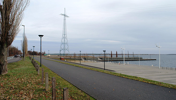
Site description
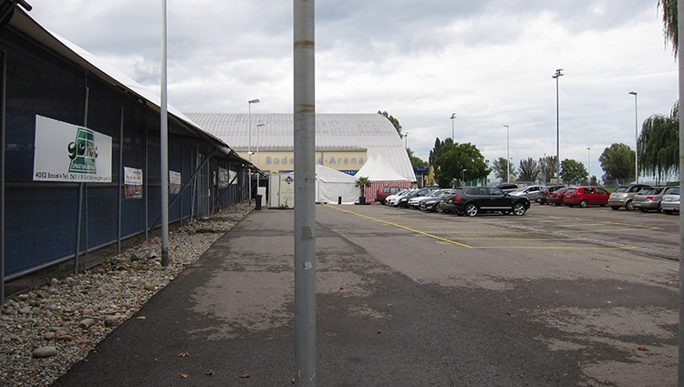
Klein-Venedig is located on the German-Swiss border, which also marks the border between the cities of Konstanz and Kreuzlingen. It stretches from the lakeshore to the railroad line, includes the art border Konstanz- Kreuzlingen as well as the Sea Life Center up to the bridge that leads over the tracks of the railroad station into the city center of Konstanz. The open spaces of the area are used on the Constance side for temporary events (Oktoberfest, concerts, etc.). The shipyard area of the Lake Constance shipping company is also up for reorganization. On the Kreuzlingen side, the area is characterized by small and medium-sized commercial enterprises as well as a sports school, which is currently to be expanded into a private school campus. The use of the Bodensee Arena with ice rink and tennis hall is fixed until 2024.
City in transition: essential elements
For both communities, good and attractive access for non-motorized traffic is to be ensured, public transport and bicycle traffic are to be strengthened, and an increase in traffic congestion in the city centers is to be avoided. In particular, concepts to cope with the temporary overload of cross-border commercial traffic are required. The lakeshore is to be kept free as open space for public uses. Planned individual traffic measures - such as a Lago South rail underpass, the extension of the promenade network, a parking garage on Kreuzlingen territory with a bridge connection between the city center and the lake across the railroad line - are to be integrated into the urban development concept. Both cities are pursuing cross-border development with a focus on leisure/recreation/events/culture. On the territory of Constance, a fairground, the upgrading of the shipyard area, the spatial frame to the railroad as well as a development concept for the area Lago South as a mixed-use quarter are to be included in the overall concept. The municipality of Kreuzlingen envisions an attractive mix of service/hotel/commercial/tourism/recreation uses, the long-term relocation of commercial operations southwest of the Seestrasse, and the medium-term deconstruction of the Bodenseearena, in 10-15 years at the earliest. The public character of the area for the population and tourists is to be emphasized over preferential privatization. The special challenge is to programmatically develop building and utilization structures in harmony with the natural surroundings.
E12: Mannheim
Site Brief Description
Category: urban planning-architectural
Team representative: architect/urban planner/landscape planner
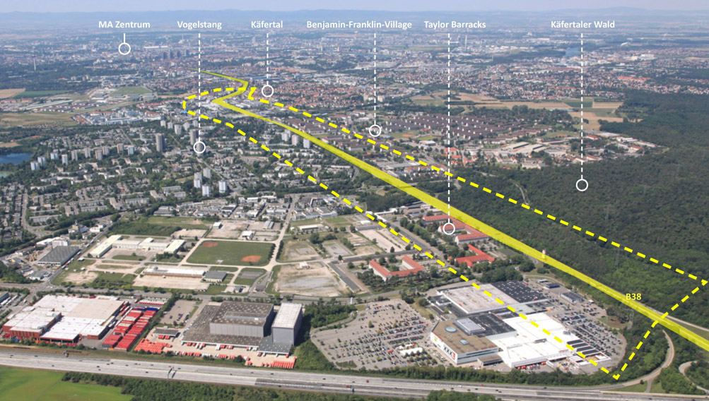
Location: Mannheim - city entrance northeast
Inhabitants: 330,000
Scope: approx. 180 ha
Project area: to be defined by the participants
Proposed location: City of Mannheim
Property owners: Federal Republic of Germany (BImA), private owners, City of Mannheim
Type of commission: Feasibility study, urban master plan.
Adaptable City - Thematic Framework
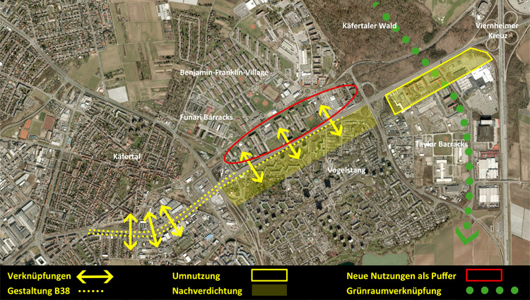
In June 2010, U.S. military leadership announced that military sites would be phased out by 2015. The release of Taylor Barracks and Benjamin Franklin Village now opens up the opportunity to positively change the city's development at strategically important locations and to further expand its urban self-image as a strong European city. For example, the northeastern entrance to the city is to be redesigned and the areas along the B 38 route are to be given a new character. The development of an engineering mile along the B 38 between the city center and the highway access at the Viernheimer Kreuz interchange represents a special potential. It forms the backbone for the future Mannheim development corridor.
Strategic goals
The promising entrance situation at one of the main access roads to Mannheim is currently not being used appropriately in terms of construction. The conversion areas offer the opportunity to rethink the development corridor: The city entrance can be redefined and cross-relationships between the neighborhoods can be improved. Use, development and open space structure should define a dignified entrance situation, in which the street and street-accompanying elements form a high-quality spatial symbiosis. In the sense of sustainable development, the spatial barrier of the B 38 is to be softened and the interconnectedness and interweaving between the individual quarters and uses is to be strengthened.
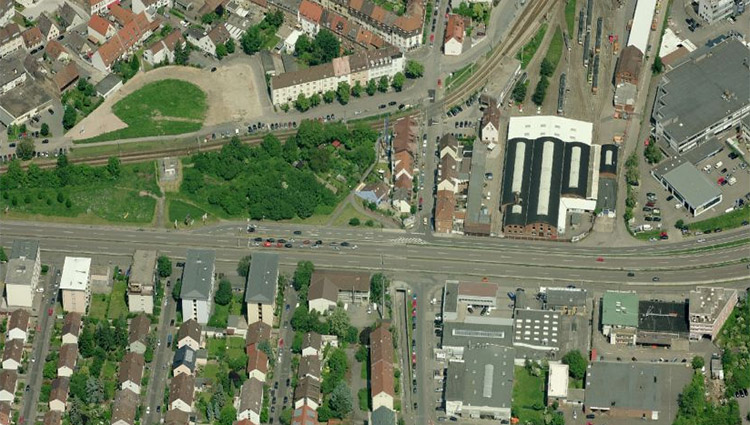
Site description
The area under consideration is characterized by a particularly favorable location (MIV, ÖV), heterogeneity and a low design requirement. Over a length of approx. 3 km, small-scale residential and commercial areas line up with large-scale structures. The uses are car affine or turn away from the noisy route. A relationship of the development to the transit route is not recognizable. Here, the conversion areas provide the space for a strong impetus to gradually transform and enhance the character of the area. However, the freeway-like character of the B 38 poses a problem for spatial connectivity.
City in transition: essential elements
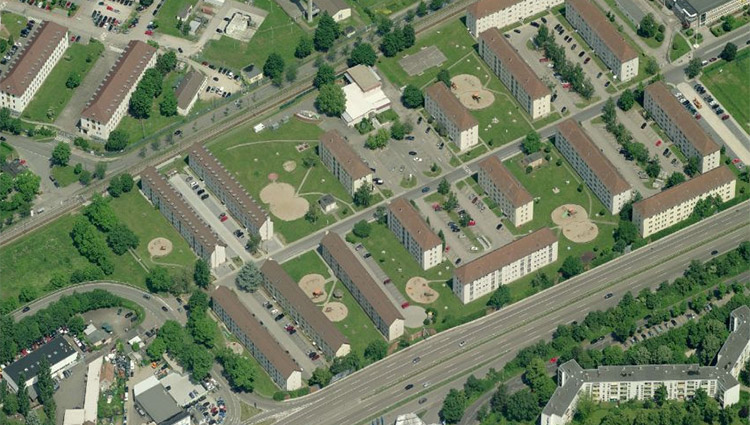
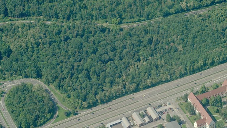
With the help of the "Ingenieursmeile" brand, innovative technologies are to be located in Mannheim. The demands on the location differ significantly from those of "classic" commercial sites. The Taylor Barracks directly adjacent to the B 38 are also to follow this program in the future, while the adjacent area to the north, Benjamin Franklin Village, with its currently vacant 2,000 residential units, is to be developed into a new urban quarter with a residential focus. Innovative architectural and programmatic ideas for development are sought for the areas immediately adjacent to the B38 here. With regard to connectivity issues, the goal is to create short routes and find solutions that provide space for new forms of mobility and encourage non-motorized traffic. A high level of bicycle comfort should support the development of environmentally friendly mobility un- der. Additional potential results from the integration into a large-scale open space system of green corridors and caesurae. Within the framework of the competition, proposals are to be developed that can provide answers to the formulated planning goals within the built green and open space inventory as well as on the disposable areas. In a first step, the area under consideration is to be investigated and analyzed in order to show the options of planning and design interventions, if necessary only selectively.
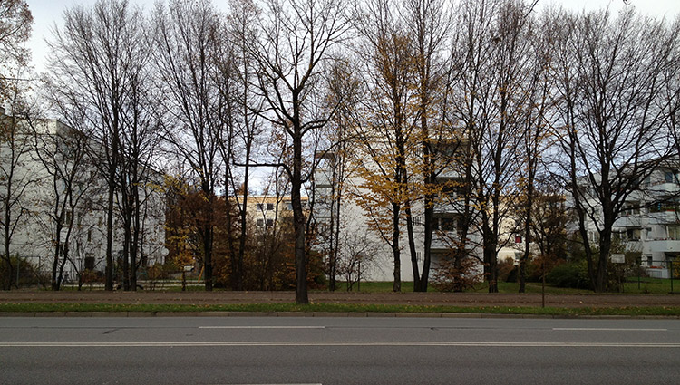
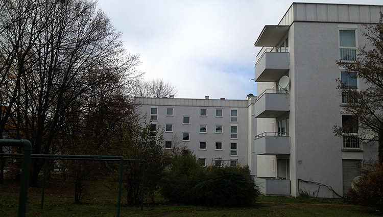
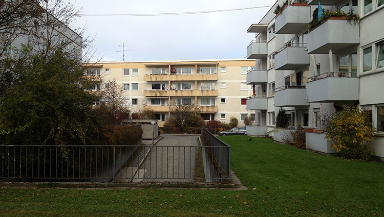
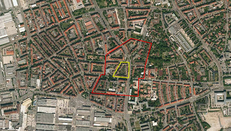
E12: München
Location brief description
Category: urban planning-architectural
Team representative: architect
Location description: Munich - Bacherstraße
Inhabitants: 1,382,000
Project area: 6,130 m²
Proposed location: GEWOFAG Wohnen GmbH
Property owner: GEWOFAG Wohnen GmbH
Type of commission: A separate award procedure according to VOF is required for the award of a planning contract. It is planned to commission the construction of new apartments, parking facilities as well as the renovation and addition of new floors to the existing buildings.
Adaptable City - Thematic Framework
The task is to redesign residential quarters built in the 1960s and 1970s along the Mittlerer Ring, a busy and noisy main thoroughfare, to make them fit for the future. On the urban planning level, this means reorganizing the neighborhoods through redensification and strengthening noise protection from the road. At the building level, new typologies are to supplement the housing supply in the existing stock. The existing rows of buildings are to be renovated in terms of energy efficiency and, if necessary, topped up. An architecturally sophisticated neighborhood with a diverse range of offerings for different groups of residents is to be created.
Strategic goals
"Wohnen am Ring" (Living on the Ring) is a development program of the City of Munich to improve the quality of living on the Mittlerer Ring. In order to prepare these popular residential quarters for the future, due to their favorable location - close to the city center and with excellent transport links - particular attention is being paid to improving the quality of living. The aim is to promote innovative ideas for noise abatement measures that simultaneously provide a plus in residential value and quality of life for residents. The location of the noise protection development to the south poses a particular challenge in this respect and requires new, intelligent solutions.
Site description
The Bacherstraße area is located south of the city center in Giesing, directly on the Mittlerer Ring, Chiemgaustraße. The rows of buildings are at right angles to the street, so that there is a high level of sound reinforcement throughout the residential complex. There is an underground car park on the site, which is in very poor condition. The competition task is the redensification of the area with a noise protection development to the south of the busy Mittlerer Ring in combination with the construction of a new parking facility. In the context of the planned energetic renovation of the existing row buildings, it is to be examined to what extent the buildings offer potential for adding storeys.
City in transition: essential elements
Living on the Mittlerer Ring offers excellent transport links, both in terms of private transport and public transport. Bus and subway can be reached in just a few minutes. Redensification of these neighborhoods, which have excellent infrastructure links, contributes to sustainable urban development that makes optimum use of existing resources. The goal is to offer attractive living for a wide variety of population groups. The question of distance and proximity and the resulting density is of particular importance here. Quiet living represents a special quality, especially in our fast-paced society. The "Wohnen am Ring" ("Living on the Ring") program is intended to develop existing residential neighborhoods close to the city center in a way that is fit for the future by means of energy-efficient refurbishment and effective noise abatement measures. The planned building densification is intended to provide noise protection for the buildings behind it and at the same time offer sustainable residential typologies, also against the background of demographic development. Successful solutions are expected for the spatial and architectural design of the connection of the noise protection development to the existing buildings. The goal is to enhance the existing neighborhood through innovative approaches to intelligent building typologies and floor plan concepts that go beyond the reproduction of already known solutions.
E12: Nürnberg
Location brief description
Category: urban planning-architectural
Team representative: architect
Location: Nuremberg, Südstadt
Inhabitants: Nuremberg 505,000, Südstadt 74,000
Scope: 12 ha
Project area: 0.7 ha
Site proposal: City of Nuremberg/WBG Nuremberg
Property owner: WBG Nuremberg
Type of commission: urban planning design, realization housing construction
Adaptable City - Thematic Framework
On the site of an aging building block from the 1920s, a concise dynamizing element of urban identity is to be created for Nuremberg's Südstadt. How can the residential environment be designed to promote integration and generate added value for the district? How can we respond to changing demographic conditions and different lifestyles? In the competition area, a piece of modern urban landscape with high density and appeal is to be created, forward-looking, energy-efficient, urban housing that sees demographic change as an opportunity and the integration of diverse lifestyles as a task.
Strategic goals
Südstadt is the most densely built-up area in the city of Nuremberg. More than 15% of the city's population live here on only 2.5% of the total urban area, and the trend is rising. The average age is significantly below the urban average. With more than a third of all foreign residents in the city as a whole, it is the epitome of an international and cosmopolitan district. The task offers the opportunity to create an urban situation for living and to strengthen the importance of the district as a residential location. The proximity to the city center and the good public transport connections enable a city of short distances and urban living without the need for a private car.
Site description
The site is located about 2 km south of the city center. The surrounding area is heterogeneous. The Schillingstraße development is located on Pillenreuther Straße, which is one of the main connections from the city center to the south of Nuremberg. Shopping facilities, schools, educational institutions and green areas are available in the immediate vicinity. It is only a 15-minute walk to the important recreational area of the former Reichsparteitagsgelände. Due to the subway stop only 300 m away, the city center can be reached in 5 minutes by car. A dense network of pedestrian and bicycle paths and roads with little traffic allows for speedy progress even for non-motorized road users.
City in transition: essential elements
The Südstadt area has already undergone part of its structural transformation into the post-industrial age. Once surrounded by large industrial sites such as Siemens, MAN, Philips and the power plant union, the picture has changed. Some of the industries have been able to consolidate and strengthen the location, while other brownfield sites have been successfully converted into business incubators, commercial and service locations, or converted into residential space. The city of Nuremberg recognized the potential of this lively district early on and is trying to support the transformation of the district into a lively residential neighborhood through supplementary offers within the scope of its possibilities. In particular, integration is to be promoted and educational deficits compensated for by low-threshold offers. Located in the immediate vicinity of the project area, Südpunkt is an educational center that offers a wide range of services, from basic German courses for people with an immigrant background to opportunities for professional qualifications. It is a much-praised beacon project in the district. Another example is the Südstadtforum, which opened in 2006. Eleven social work institutions form a close-knit support network that has an impact on the district. The south of Nuremberg is a place of integration and, within the city as a whole, a dynamic district with a large number of children. This development is to be strengthened by a sustainable, diverse, intergenerational housing offer in the project area.
E12: Regionale 2016
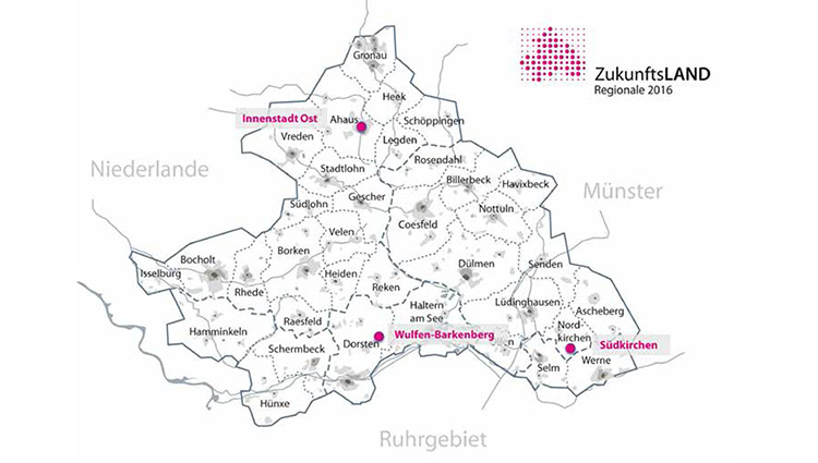
Location brief description
Category: regional-urban-architectural
Team representative: architect/urban planner/landscape planner
Location: Western Münsterland
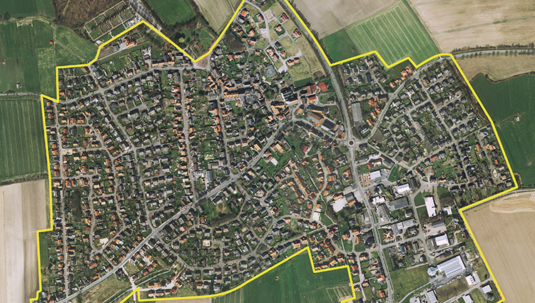
Inhabitants: Ahaus 38,989, Dorsten 76,223, Nordkirchen 10,413
Scope: Western Münsterland, Ahaus - city center east, approx. 23.4 ha; Dorsten - Wulfen-Barkenberg, 12.4 ha; Nordkirchen - Südkirchen, 93.5 ha
Project area: to be chosen by the participants
Site proposal: Regionale 2016 agency
Property owner: private owner
Type of commission: Master Plan
Adaptable City - Thematic Framework
Dealing with land use change in a sustainable way is one of the central challenges of Regionale 2016. Strengthening and upgrading existing settlement cores is necessary to limit further settlement growth into the landscape. In many towns in the western Münsterland region, large areas of detached and semi-detached houses were built like "annual rings" around the town centers in the 1950s to 1970s. How can these residential areas, which are attractive because of their central location and generous plot sizes, be prepared for the future in terms of structure, construction and design? Under the motto "Living inside - developing new qualities", this is to be examined as an example for the communities of Ahaus, Dorsten and Nordkirchen.
Strategic goals
Currently, many of these properties are undergoing a generational change due to their homogeneous resident structures - a favorable time to look for innovative strategies that enable both change and continuity. The goal is to creatively use and further develop what already exists. Urban areas and individual buildings must be thought of together with their landscape surroundings, and new elements must fit into the existing system and add additional meaning and expanded possibilities for use. How can new building and open space types be used to introduce vital functions into neighborhoods, and how can existing buildings be optimized for energy efficiency and adapted to meet today's requirements for living comfort and accessibility?
Ahaus - City Center East
For the area close to the city center from the 1950s with a homogeneous building structure, the challenge is to shape the upcoming generational change in the neighborhood and to develop perspectives for a new profile together with the "builder generation". What opportunities does a controlled urban development of the neighborhood offer? We are looking for ideas for a sustainable transformation of a 1950s housing estate. At the neighborhood level, the question is how the public space can be designed in a quality manner and enlivened with complementary functions. With regard to the existing buildings, the goal is to develop exemplary solutions for this type of settlement house, which, in addition to an energetic valorization, also include "generation-proof model floor plans".
Dorsten - Wulfen-Barkenberg
The "Neue Stadt Wulfen", a large, green housing estate from the 1960s/70s, is currently being converted for the future through deconstruction and upgrading measures. Single-family, semi-detached and terraced houses have also been built in part of the area. Their location is characterized by their immediate proximity to the large-scale center of Barkenberg. Socially and structurally, there is a clear tension in this neighborhood; the population structure in the single-family housing stock is showing the first signs of aging, and oversized infrastructures separate the areas. Images are sought for new forms of housing to complement the "large housing estates," proposals for alternative, communal energy concepts, and better networking of the neighborhoods.
Nordkirchen - Südkirchen
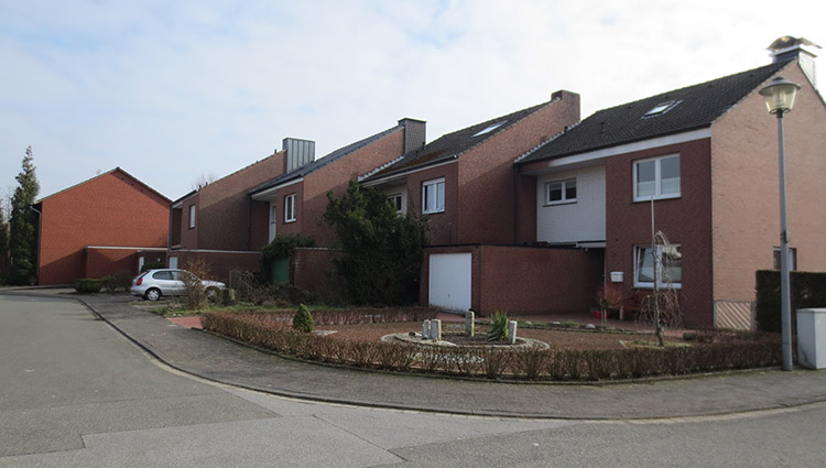
South of the well-known Nordkirchen Castle, the district of Südkirchen with its 3,200 inhabitants is located in the agricultural cultural landscape. It grew mainly in the 1950s to 1970s as a typical commuter residential area in the countryside. Retail, commercial area and social infrastructure (school, citizen bus) are "still" present in the sense of a basic supply. The city's goal is to promote a significant "rejuvenation of the district" and to present ideas for future-oriented, family-friendly living. In addition, the question arises as to which interventions can succeed in developing the district as a whole into a lively neighborhood that attracts new residents with attractive offerings.
E12: Wittenberge
Location brief description
Category: urban planning-landscape planning-architectural
Team representative: architect/urban planner/landscape planner
Location: Wittenberge
Inhabitants: approx. 18,000
Scope: linking the banks of the Elbe with the city
Project area: 5.85 ha
Site proposal: City of Wittenberge
Property owners: City of Wittenberge, municipal housing association, private owners
Type of commission: urban development framework plan, realization of individual building projects
Adaptable City - Thematic Framework
The Elbe riverbank area in Wittenberge is exemplary for urban transformation processes. The area has lost its industrial significance and is to be gradually restructured and put to new uses. An important step is the Elbe riverbank promenade that will soon be built, opening up the formerly inaccessible area for residents and visitors to the town. The area will become permeable and can interact with the city and the natural space. Against the background of the shrinking city, not all parts of the Elbe riverbank area can be developed at the same time. Interim uses and temporary solutions that keep various development options open can be part of the transformation process.
Strategic goals
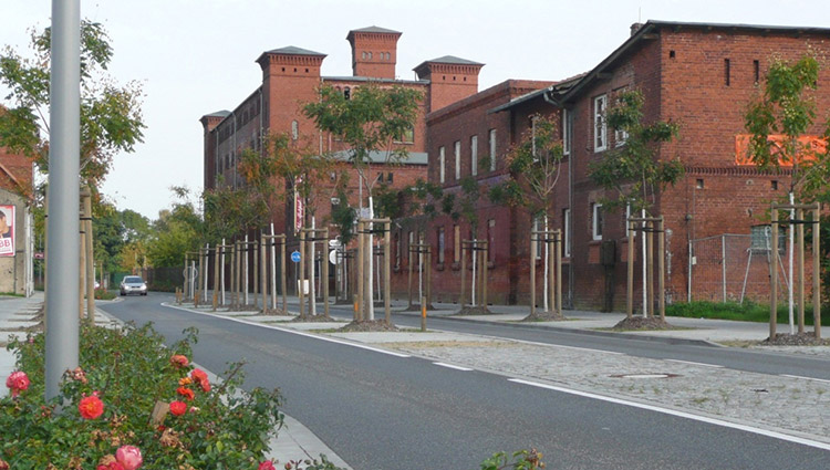
Due to a massive loss of its industrial base after 1990, the city of Wittenberge had to cope with considerable population losses from 27,000 inhabitants at that time to 18,000 today. Wittenberge is part of the regional growth core of Prignitz and, together with the neighboring town of Perleberg, is a medium-sized center for a sparsely populated surrounding area. Situated halfway between Berlin and Hamburg, the town's urban development policy focuses on consolidating its function as an industrial location, its very good rail connections and its attractive location as a gateway to the Elbtalaue. Urban redevelopment measures focus on maintaining and revitalizing the city center and consolidating the existing buildings that characterize it.
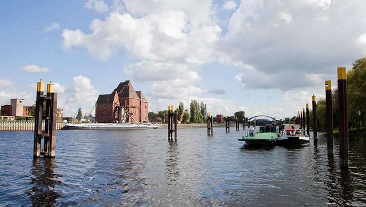
Location description
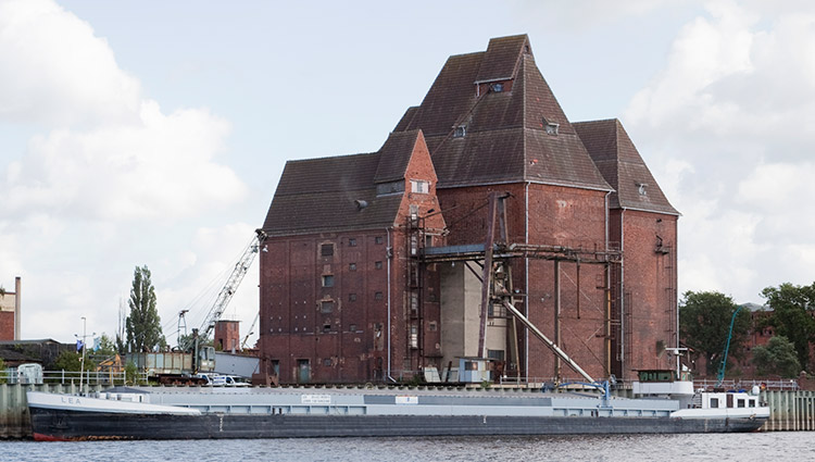
The core area is the area of the former city harbor between the oil mill site and the historic city center. The area is of particular importance to the city's history, since industrial development began here with the construction of the main customs office in 1820 and the Herz oil mill in 1823. The area of the city harbor lies fallow, as do the adjoining properties that were formerly used for commercial purposes. Of particular importance are the listed warehouses standing directly on the water's edge as witnesses to Wittenberg's economic history and as an important part of the city's skyline. They are to be structurally secured and put to a new use.
City in transition: essential elements
The goal is to create an urban development concept that can also be implemented gradually under the conditions of a shrinking city. At the center of the task is an economically feasible subsequent use for the warehouses, which are to be integrated into an overall urban development concept together with the surrounding historic buildings and a comprehensive architectural addition. The "time" factor plays an essential role here. Which areas should be developed as a matter of priority and which areas are suitable for temporary interim solutions? One example of a successful transformation is the "Alte Ölmühle" industrial monument, which is now a cultural-tourism venue of regional significance. The site is an interface between the city and the Elbtalaue Biosphere Reserve, a natural area of special quality. The interaction with the surrounding landscape must be taken into account in the design of the open space. The integration of the Elbe riverbank area into the overall urban context is an essential part of the task. The connection via the Packhof green corridor to the train station as well as the link with the inner-city shopping area, the Bahnstraße, are of essential importance. Here, the focus is on ideas and solutions for an improved experience of the different urban spaces and a better orientation in this extensive area at the edge of the city center, which is characterized by deconstruction measures and empty spaces.